Hike | Organ Pipe Cactus National Monument | United States
Arch Canyon Trail, Organ Pipe Cactus NM (Hiking Guide)
Text | Anninka Kraus
Photography | Tobias Kraus

US Arizona
Starting from a little parking area off Ajo Mountain Drive, the Arch Canyon Trail is a challenging but fun 4-kilometer (2.5 miles) out & back hike in the western Ajo Mountains. It’s quite a steep scramble to the top but well rewarded with grand views from the double rhyolite arches that naturally frame the vast reddish-brown desert landscape.
The Arch Canyon Trail is split into two sections: the opening stretch is a well-maintained, Class 2 trail that ventures 1.1km (0.7 miles) into Arch Canyon. Where that trail ends, you’ll see a warning sign at the start of the more challenging and unmaintained track marked with cairns that climbs right up to the arches. That second part is way more challenging than the first section, although not too technical and definitely doable for experienced hikers.
To reach the arches, you must follow that steep, switchbacking path beyond the maintained trail. The maintained Arch Canyon Trail does not access the arches, nor offers any outstanding views – apart from the canyon’s lovely desert vegetation, I thought this trail section was a little underwhelming, in fact. If you don’t plan on hiking all the way to the top, I’d skip the trail altogether, to be honest, and enjoy the wonderful view of the two arches, one sitting on top of the other, from the parking area.
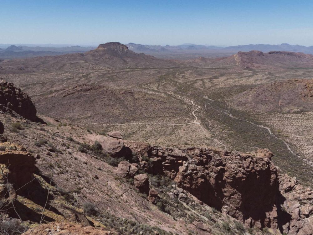
Those ready for a more challenging hike are in for a real treat. You’ll be scrambling up the steep rocky trail, up and around craggy outcrops of stone, until the track levels out somewhat near the top of the ridge. With the cliffs falling off almost vertically, this spot has incredible views across the desert plains dotted with cacti, and each was throwing a short shadow in the morning sun. To get to the larger of the two arches, continue down into a gully behind you to your right (facing the desert plains).
Take your time on the descent though, which I found to be steep and slippery, with lots of loose rocks and small gravel. Then, once again on solid ground, you’re standing right underneath the almost 30-meter wide arch (90 feet). The views are marvelous, and with plenty of space to sit and rest, this would make a fabulous lunch spot.


Organ Pipe Cactus National Monument | Arizona
Hike | Out & back trail | 1.5-2 hours
track details.
Start/End: parking area off Ajo Mountain Drive
Distance: 4.1km (2.5 miles)
Time: 1.5-2 hours
Elevation: 400 meters (+/-) (lowest point: 785m / highest point: 1070m)
Difficulty: moderate-challenging (steep inclines, loose footing)
Best time to hike: early morning or late afternoon during the winter months (December-March)
Further information: Official National Park Service website / note that there are no restrooms provided at the parking area