Travel resources | Orientation, GPS
How to use gps for hiking
Text | Anninka Kraus
Photography | Tobias Kraus
How is gps useful?
Tobi loves maps. Not a single visit to the book store or outdoor shop goes by without him poring over an assortment of paper maps, spread out across a large table. Before any multi-day trek, I actually urge him to buy one. This is simply because maps make him happy, not because we’d be lost without one.
Tobi doesn’t need maps. It appears his brain was fitted with an internal, infallible GPS chip. His ability to visit a place once, and then years later still know how to get from A to B in a jungle of small, identical looking, narrow streets, astonishes me.
More astoundingly still, we’re hiking, in the middle of nowhere, and the trail has disappeared into oblivion, but he knows which way to go; by using the location of the sun. My sense of direction has never failed me either. I simply don’t have one and would never rely upon it.
For people like me, there’s Google Maps and TomToms. We’d be totally lost even in everyday life otherwise. I spent one year in the field sales force of a confectionary company, managing a few dozen stores, and thanks to the TomTom I managed quite well. This was until about four weeks before the year was up, and the TomTom broke. For eleven months, I had visited a large wholesale store right next to the highway twice a week. It was only thanks to the huge blue-yellow METRO sign that I knew which exit to take in month twelve. I’d rather not recall the odyssey into the outskirts of some larger cities.
So, you can probably imagine that the prospect of hiking in rough backcountry terrain is somewhat disheartening. I can more or less decipher a map, a large-scale one with proper labels and such. However, answering “where am I?” on that map, remains a total mystery, unless I use Google Maps on my smartphone with location tracking turned on, which works well in urban settings with a stable internet connection.
Thankfully, one doesn’t need WIFI or cellular reception for GPS to work and the latest smartphones are all fitted with a GPS chip and therefore work as equally useful GPS devices for hiking, running and walking. They’ve become quite indispensable to us in off-road locations, especially when we don’t just care about getting to our destination, but want to follow a particular route.
We download a GPS track (recorded route to a destination containing geographical coordinates, altitude and distance) in a gpx (GPS exchange format) or kml (Keyhole Markup Language) file format and navigation is super easy, even for me.
Handheld GPS devices also do the trick but since I carry my smartphones with me on hikes and runs anyway, I have never considered an additional piece of gear.
Following the battery management guidelines below, we manage 5+ days of battery life in the outdoors. Tobi uses both his phone and his gps watch, a Suunto Ambit 3. The watch doesn’t support maps but is useful to record our tracks.
related.


What are GPS tracks?
Guide to using GPS tracks for hiking, walking & running
GPS tracks are trails made up of GPS track points and contain information like geographical coordinates, distance, altitude, and time in gpx or kml/kmz (compressed kml) file format. These allow you to navigate a specific path previously taken and tracked (by someone else).
How to use GPS tracks? Easy step-by-step process
1. Download an app that supports GPS tracks and topographic offline maps, and allows you to import and export gpx and kml/kmz files. We use Maps 3D for hiking (one other app is Gaia GPS) and Runkeeper for running and walking (Strava is another option). We always use the gpx format as that contains more information than kml files.
2. Take some time to get used to the app and its features.
3. Download a gpx file for offline use before your trip, while you still have an internet connection. Good sources to download GPS tracks for hiking and running include Gaia, MapMyHike, MapMyRun, Alltrails, and Outdooractive. We also provide gpx files of all our hikes, runs and walks for download.
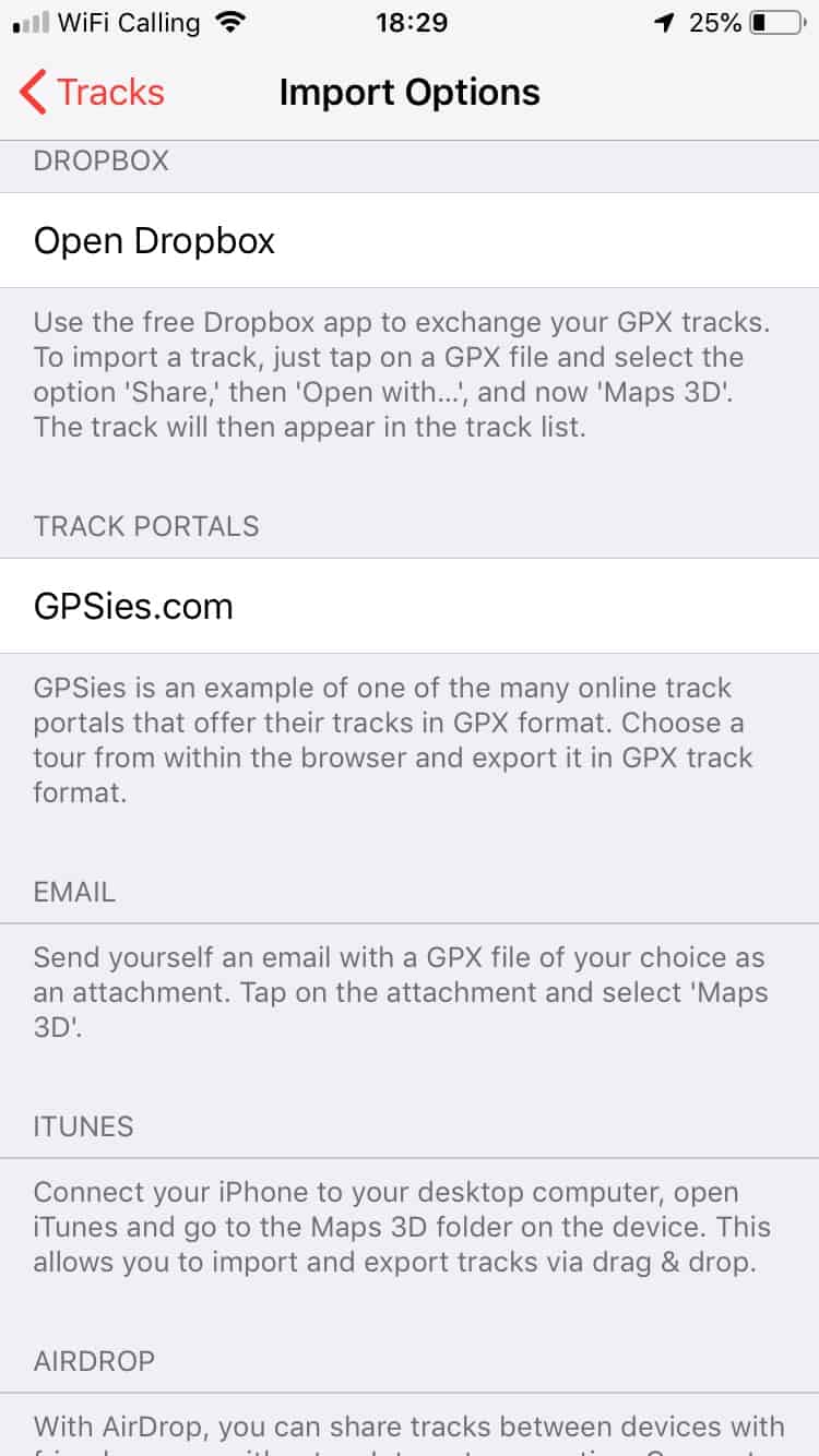
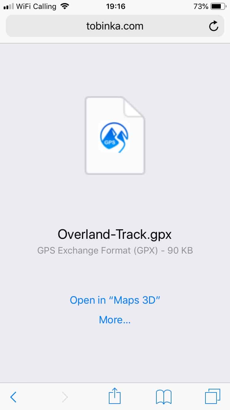
4. When you download a gpx file on your smartphone you may be able to import the file directly into the app you’re using. If not, you can send yourself an email with the gpx file attached (or use Dropbox or Airdrop), open the attachment, and upload the route to the app this way.
Hiking with GPS
Battery management, recharging & smartphone protection
On multi-day trips, good battery management is key unless you have the possibility to recharge your phone on the way.
On our smartphones, we turn Airplane mode ON (WIFI, Bluetooth, and Personal Hotspot OFF) to conserve battery life. While all cellular activity is thus disabled, GPS is still enabled. We also recommend minimising screen brightness.
On longer trips, turn off tracking mode if you don’t need to record your track and set your GPS app to engage the GPS only when you manually request it.
Check which apps have the highest battery drain (iOS: Settings > Battery > Battery Usage) and shut down or turn locations services off for any app that may engage the GPS unnecessarily in the background (ie. tracking apps such as Runkeeper, Google Maps or facebook). We always take a Power Bank for backup on longer hikes if we think we may need it. Depending on the climate you’ll be in, a solar charger may also be an option.
If you do use your smartphone as a wilderness GPS device, you may want to protect it from water, sweat and scratches using a Zipper storage bag, and in very wet environments a waterproof case in case your phone isn’t completely waterproof anyway.
Tobi still loves marking out possible routes on paper maps and I assume he won’t surrender them anytime soon, which is just as well. Taking a paper map and a compass with you when you are backcountry hiking is a simple safety precaution, just in case there’s no GPS signal. The latter is unusual, but we had to do without GPS signal in the deep canyons in the Naukluft Mountains and occasionally in dense forest.