Hike | Canton of Grisons | Switzerland
Hiking the Swiss Grand Canyon
Text | Anninka Kraus
Photography | Tobias Kraus

Switzerland
When I learned that the Swiss call a gorge not far from us the ‘Swiss Grand Canyon’, I wanted to go at once. The Grand Canyon in the States had been such spectacular sight that if anything even remotely similar existed here, I really wanted to see it. But it doesn’t. As much as the Swiss might like to have a Grand Canyon, the Rhine Gorge (also called Ruinaulta in the Rhaeto-Romanic language spoken by 0.5 percent of the Swiss), it is not.
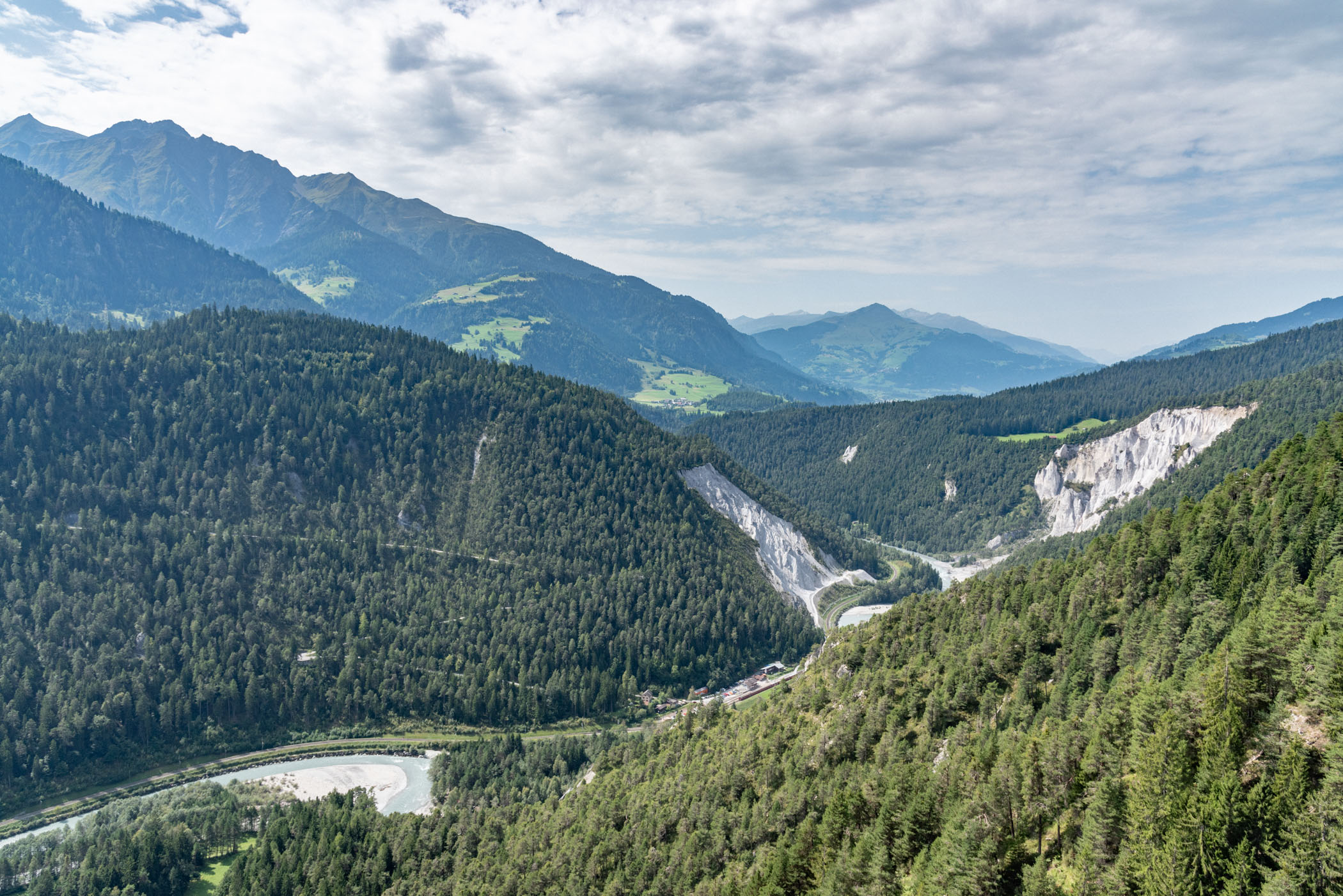
That being said, the gorge is still spectacular and well worth a visit. For 14 kilometres between Ilanz and Reichenau in the canton of Grisons (Graubünden) the Rhine travels between the steep canyon walls up to 400m below the rim.
The trail starts in Flims, a well-known skiing region that has hosted FIS World Championship events before and is home to the Caumasee, which is perhaps the prettiest lake in the whole of Switzerland. The parking lot at the trailhead (Rudi Dado Road) was already pretty full on this sunny day when we arrived mid-morning but most visitors did not look like hikers, instead carrying large picnic baskets, blankets, and towels.
They were obviously going to spend their day splashing about in Caumasee and when a lake of the most extraordinary turquoise colour, nestled in the woodlands in the valley below, came into view, I almost wanted to do exactly that – spend the day at the lake.
A small lift runs down to the lake free of charge from June to August but access to the lake is subject to an admission fee until 5 pm between the end of May and the beginning of September (12CHF adult/6CHF child). The trail was less busy once we passed the lift station but still well frequented as we walked towards Conn and the observation platform Il Spir.
The popularity of this first stretch of the route is certainly owed to the low difficulty of the trail (advertised as pram-friendly) that meanders through wildflower meadows, woodlands and past traditional chalets set against the backdrop of steep limestone escarpments. And also to the observation platform that offers outstanding panoramic views of the Rhine, a milky silver-grey stream winding in broad loops through the wide riverbed between the canyon walls – some rocky, some cloaked in greenery rising steeply to either side. When a red train, dwarfed to the size of a model railway by the distance, crossed the river and then continued alongside it, the immense proportions of the Ruinaulta became all the more obvious.
Il Spir means swift (bird) in Rhaeto-Romanic and indeed, on the platform suspended mid-air, you’ll have the feeling of soaring sky-high above the chasm.
From the platform, we backtracked a few steps before turning onto a much smaller trail forking off to the right and abruptly silence descended upon us. For the rest of the hike, we only met few other hikers of whom most hiked anti-clockwise, which I wouldn’t recommend as they really struggled up the steep slope that we descended towards the riverbed.
Standing on the riverbed of sand and pebbles at the water’s edge, the perspective of the canyon’s sheer limestone cliffs rising up vertically was entirely different than from above. Here the path crosses the Rhine on a rail bridge and follows the river loops with some ups and downs in elevation through woodland and meadows towards the train stations of Versam-Safien and Valendas-Sagogn.
At Valendas-Sagogn we crossed over the Rhine again and continued on an uphill climb past Laax and Murschetg through woodlands and meadows. We were sweaty and exhausted and really looking forward to a swim in the lake but some clouds had started to drift in after lunch and by the time we drew close to the trailhead a slate grey sky threatened rain at any moment.
And indeed, the minute we arrived at the car a torrential downpour sadly killed that idea. But we’ll gladly come back here, for that swim and another hike into the gorge.
related.


Caumasee is a lake of the most extraordinary turquoise colour and perhaps the prettiest lake in all of Switzerland.
Canton of Grisons | Switzerland
Hike | Loop trail | 5-7 hours
track details.
Start/End: Flims (highest point: 1115m / lowest point: 655m)
Route through the Swiss Grand Canyon: Flims – Caumasee (Lake Cauma) – Conn – Il Spir – Versam-Safien – Valendas-Sagogn – Flims
Distance: 19km
Time: 5:15 hours
Elevation gain: 680m