Hike | Pilbara region, Western Australia | Australia
Explore the best walks in Karijini National Park
Text | Anninka Kraus
Photography | Tobias Kraus

Australia Western Australia
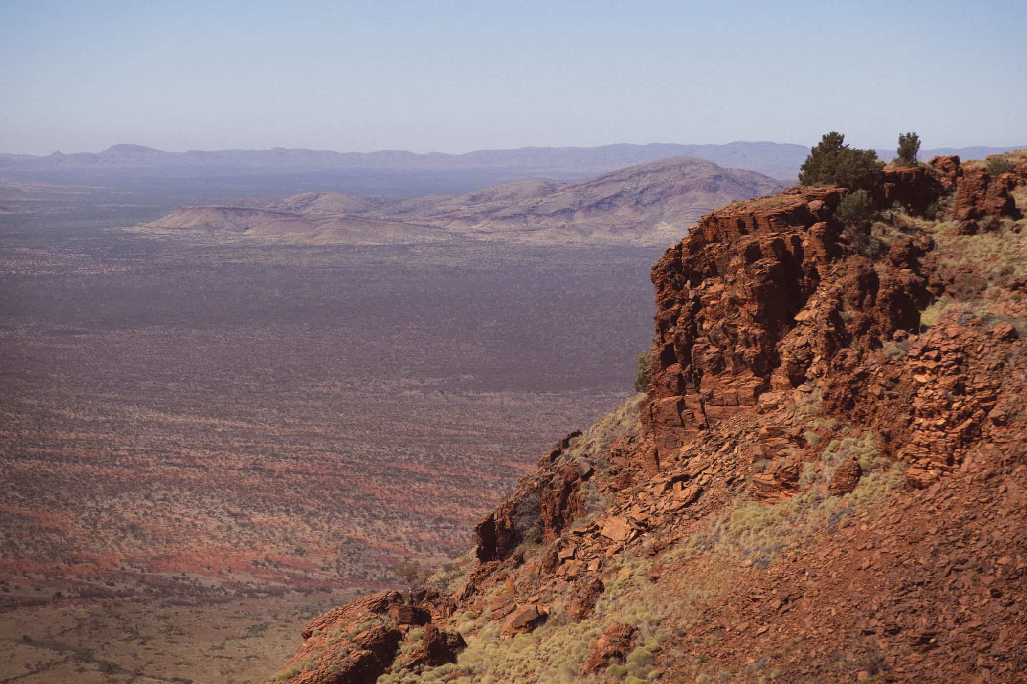
Karijini National Park is located just north of the Tropic of Capricorn, on a remote high plateau at 685m above sea level. The traditional Aboriginal landowners know the Hamersley Range as Karijini, hence the name of Australia’s second-largest national park.
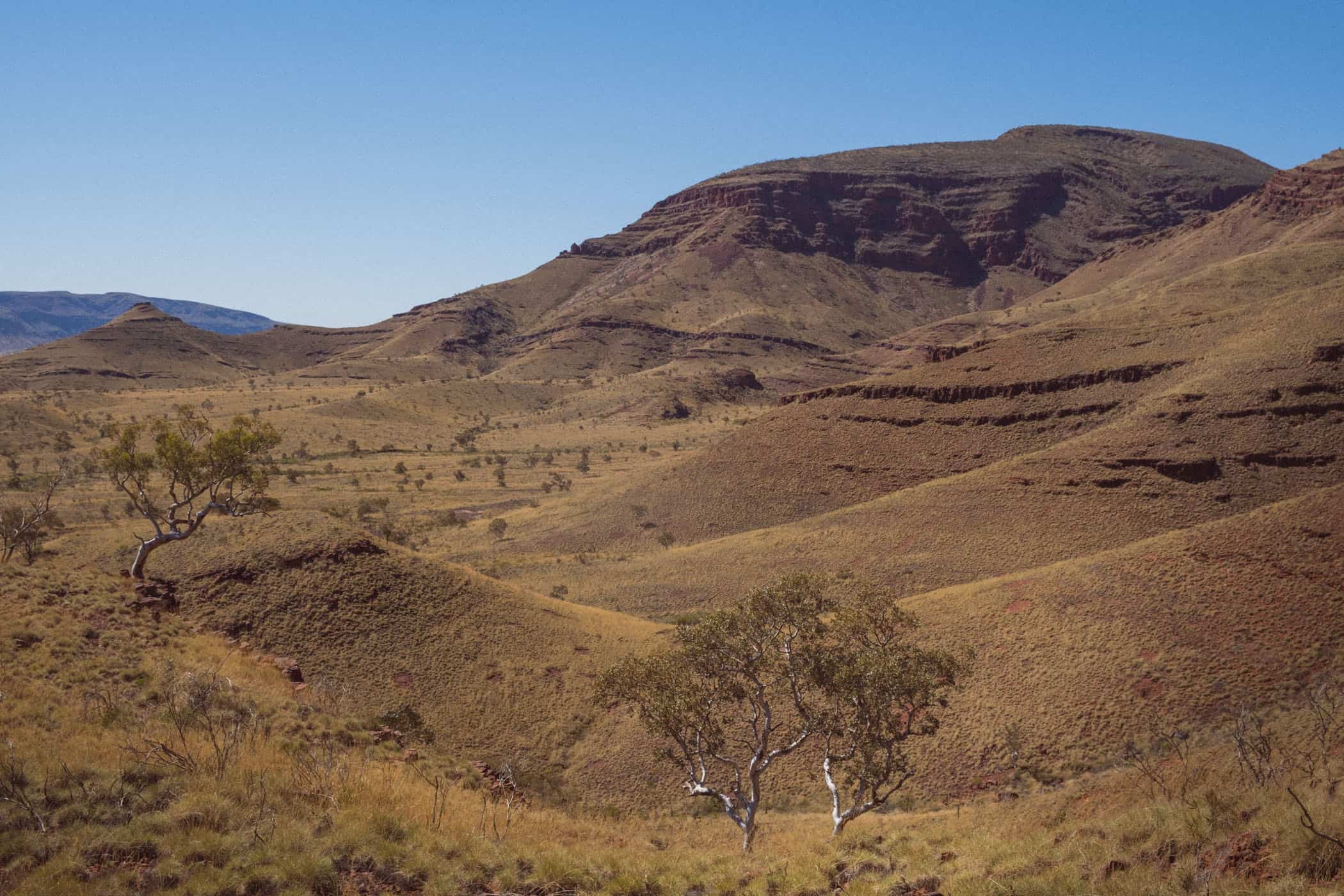
Travelling to this remote place in the Hamersley Range in Western Australia’s inland Pilbara region, you’ll discover an ancient country. A rugged landscape of glowing red soil with beautifully marbled rock gorges that started forming over 2 billion years ago.
Earth movements and erosion have sculpted majestic mountains millions of years old that rise from the vast plains. Information boards in the park explain how these mountains, in a never-ending process, are slowly worn down by wind and water and will, in time, crumble to dust. The dust will eventually be deposited on the seafloor where these iron-rich sediments are compressed into rock and lifted above sea level, only for the forces of erosion to yet again show their might.
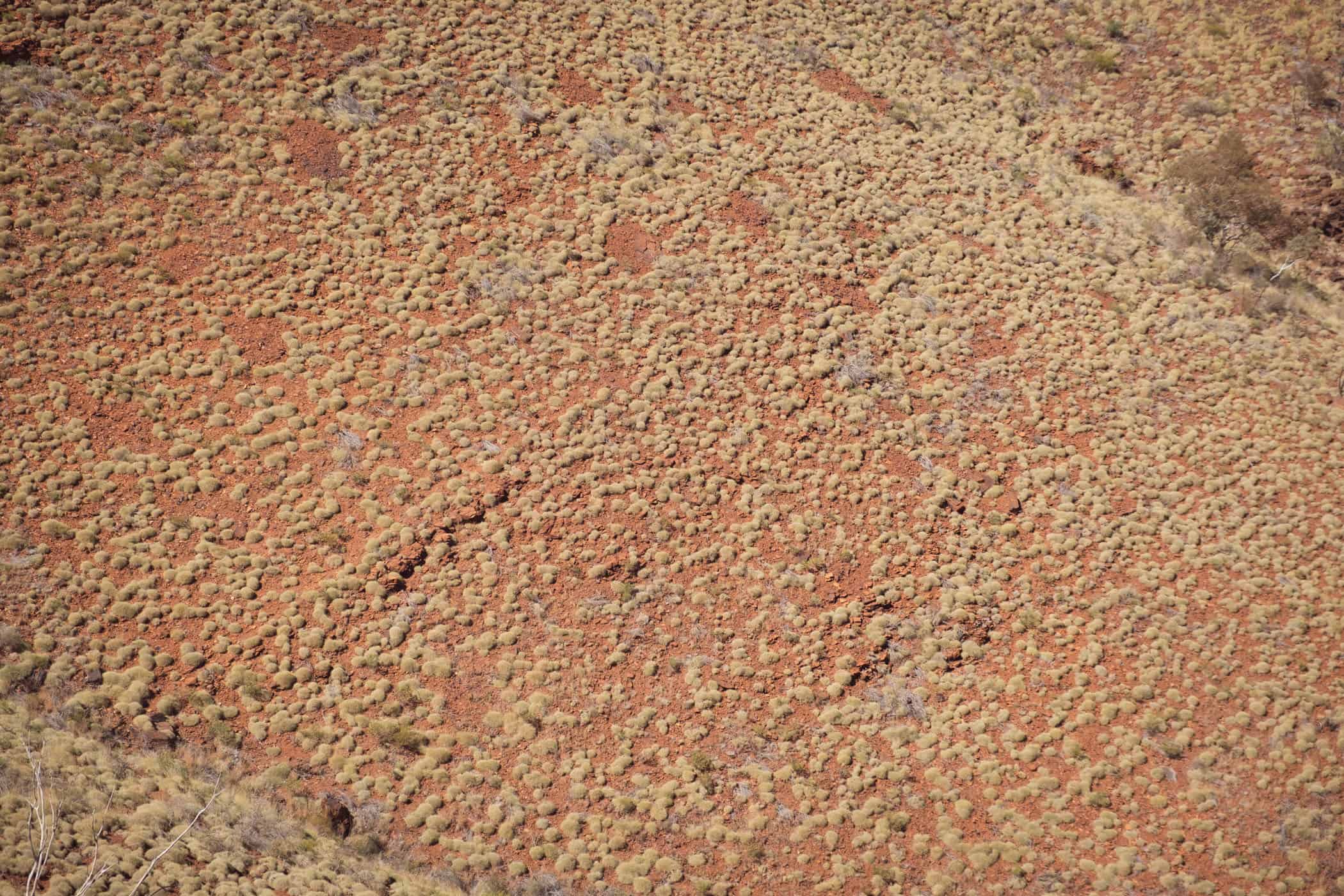
The resulting scenery is marvellous. Deep gorges cut through slabs of smooth, purplish-red rock that shines in the sun like polished marble. Inside the chasm, gushing waterfalls and crystal-clear rock pools feed an oasis of wetlands thriving in the shade of large trees. We visited in winter when colourful wildflowers also added much beauty to this barren wilderness.
Karijini is divided into sections based on the gorges that dissect the park and the one mountain that you can climb, Mt Bruce. Kalamina Gorge has 4WD access only (also, Joffre and Weano Gorges are 4WD accessible via Banjima Drive), but most sights are 2WD accessible, albeit via a corrugated gravel road.
These include Mt Bruce (6km return on gravel), Hamersley (108km return on gravel roads), Knox (roughly 10km return on gravel roads), and Hancock and Weano gorges (26km return on gravel roads). Only Dales and Joffre gorges (via Karijini Drive) have sealed access roads.
Due to the high number of park visitors in 2021, corrugations on these gravel roads were quite bad and the reason we skipped several gorges, including Kalamina and Hamersley, supposedly the nicest ones in the park. From the photos I’ve seen, however, I’d highly recommend a visit if you don’t mind a long drive on heavy corrugations. But check road conditions with staff at the Visitor Centre when you arrive – you may be lucky that the grader has just gone through.
Several walks of varying levels of difficulty reveal Karijini’s unique landscape features. They range from a short Class 2 stroll onto a lookout platform to the challenging Class 5 half-day climb of Mt Bruce. There’s much to see in this national park and you can easily spend 2-3 days or longer exploring the scenery, hiking, and swimming in the rock pools.


location & park information.
Accommodation in Karijini National Park: Camping is available at Dales Gorge Campground (operated by Parks and Wildlife
Service) and Karijini Eco Retreat (commercial retreat and campground with full facilities). The facilities at Dales are very basic (bush toilets, untreated water, rubbish bins), but hot showers are available at the Karijini Visitor Centre between March and November ($4/shower + $20 key deposit; arrive by 3pm as the Visitor Centre closes at 4pm). Pre-book camp sites in high season when the campground may be fully booked for several weeks in advance.
There’s no shop or petrol station in the park. The closest town is Tom Price, an hour’s drive from the Visitor Centre in Karijini.
Driving in Karijini: The park itself is 2WD accessible, however many gravel roads inside the park are heavily corrugated and you’ll be better off in a 4WD.
Best time to visit Karijini: March-November; night time temperatures in winter can be freezing
Permits: You need a national parks pass to enter Karijini and camping fees apply.
Karijini National Park | Australia
Hike | Out & back trail | 3-6 hours
Mt Bruce
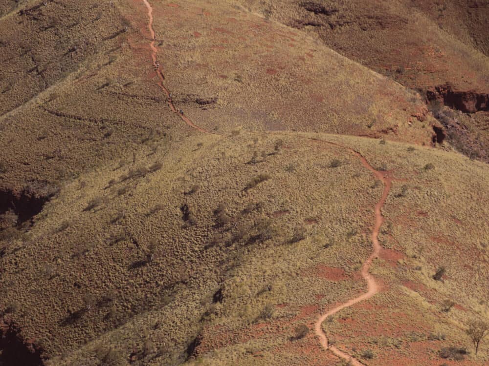
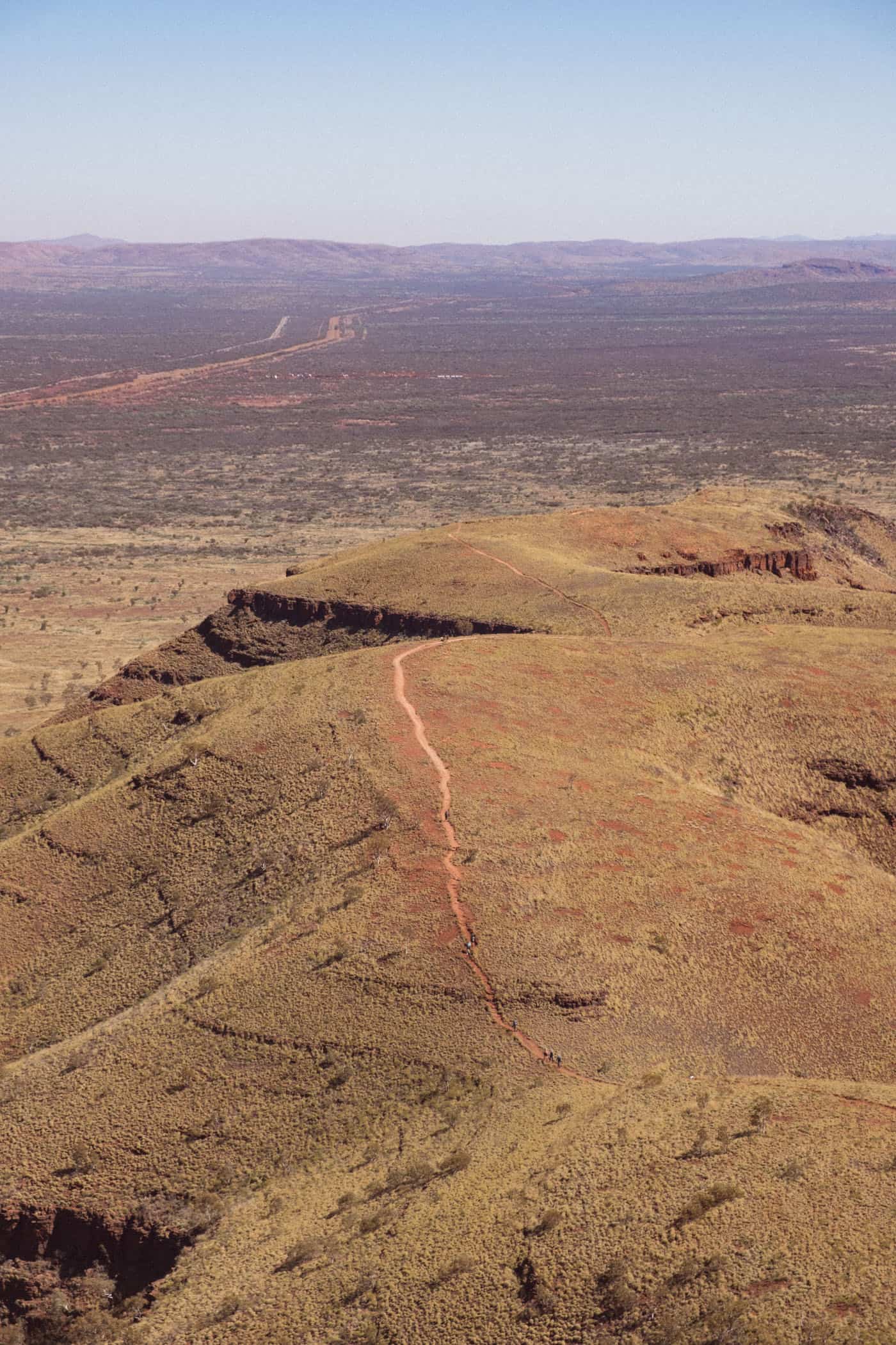
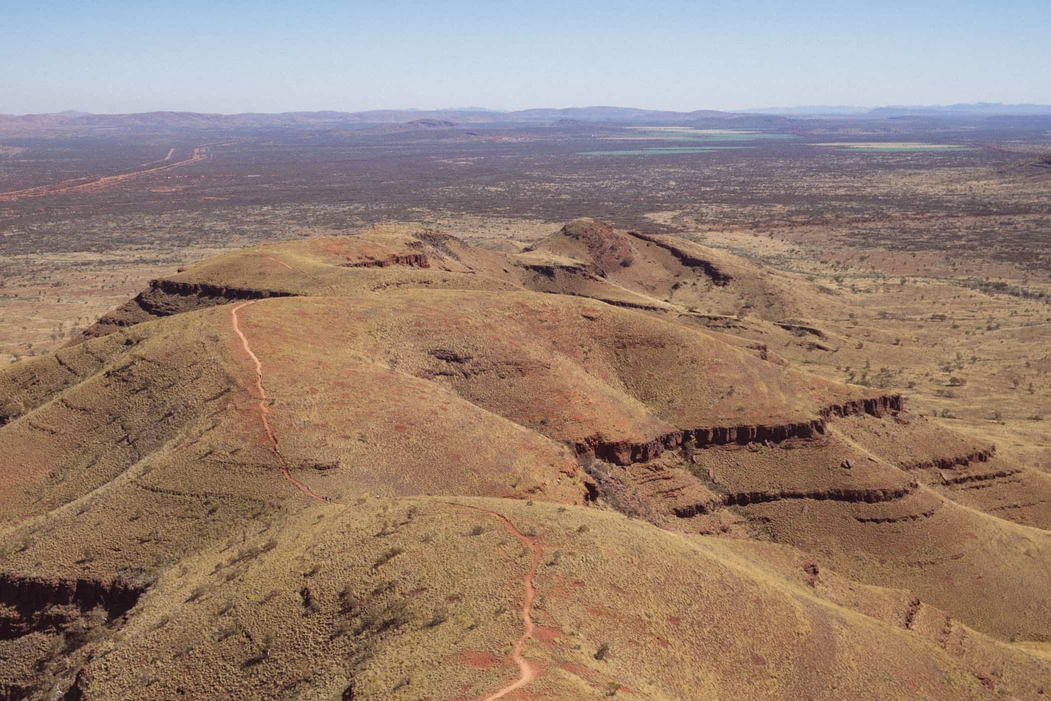
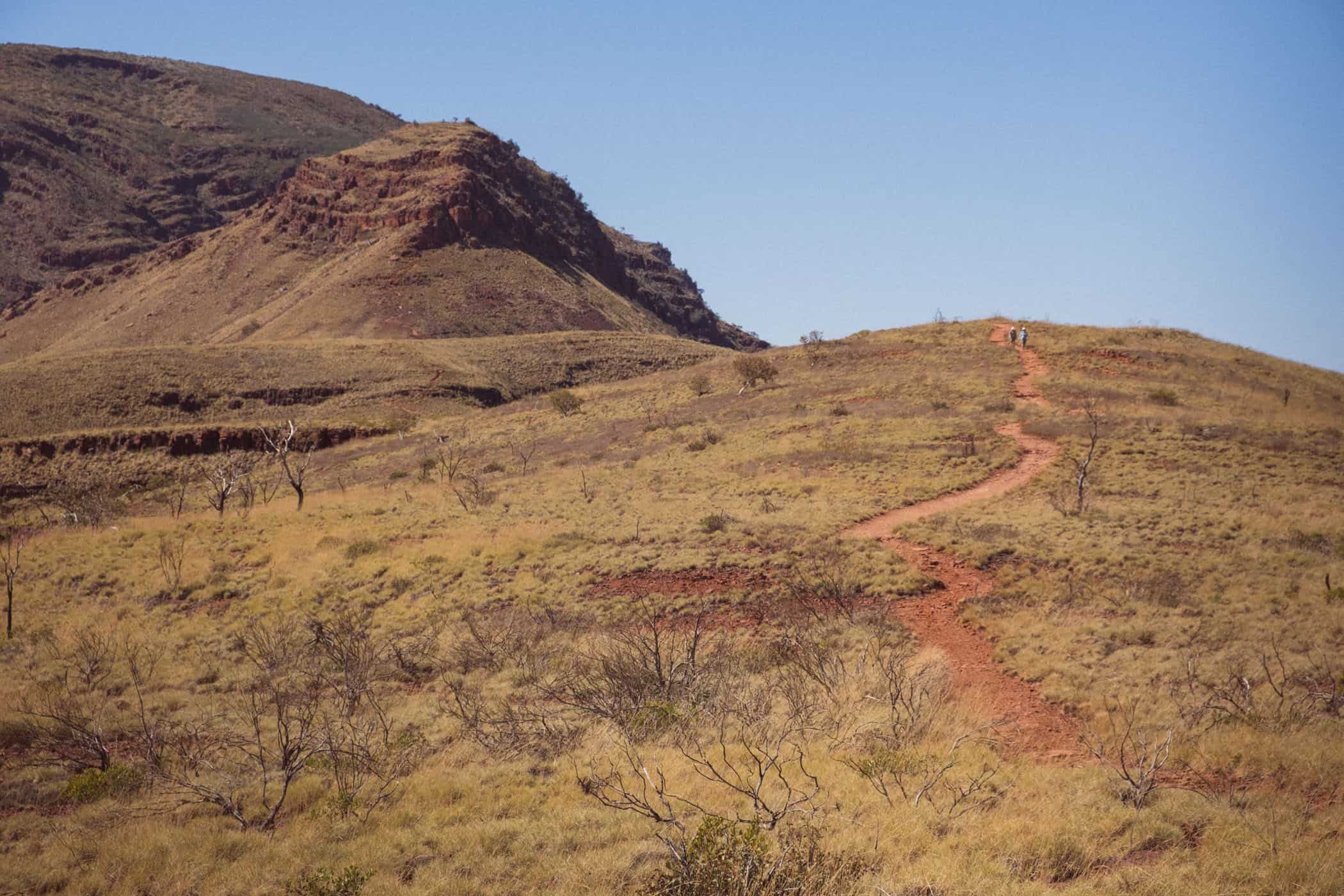
The climb of Mt Bruce, the second-highest mountain in Western Australia, standing at 1235m, is the only hike in Karijini National Park that takes you onto a mountaintop and rewards the effort with panoramic views over the landscape. All other walks with elevation gain descend into one of the gorges that crisscross this purplish-red scenery.
Parks and Wildlife Service’s generous estimate for the 9-kilometre Class 5 trail with almost 600m elevation gain is six hours and probably factors in 40+ degree temperatures in summer. I don’t however recommend this hike in the summer heat as there is no shade. In winter, experienced hikers should easily manage the return trip in 3-4 hours.
The trail is well-marked and not technical, but rocky underfoot. A few sections require some rock scrambling and one steep drop is secured by a metal chain. It is a demanding hike for most, but the views are grand throughout and the track can easily be shortened. The Marandoo View (Class 2) and Honey Hakea tracks (Class 3) are both short sections of the Mount Bruce Summit walk and will take 30 minutes and 3 hours respectively.
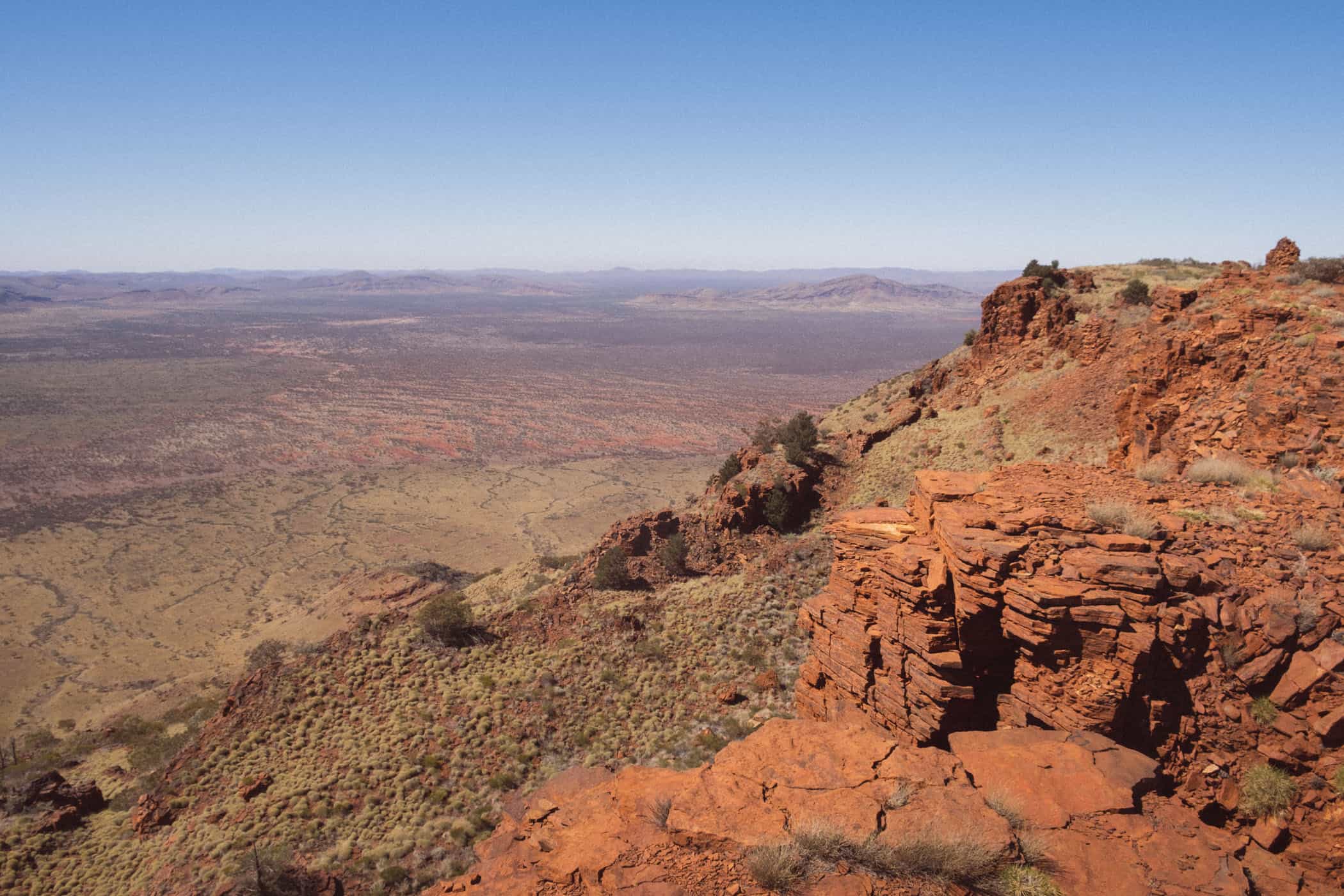
A few minutes into the walk, we came to the first lookout point with views over the Marandoo Mine that has produced iron ore since 1994. When iron deposits were suspected in this area in the early 1990s, parts of the national park were simply converted into a mine.
We were surprised by the indifference and lack of support shown towards this protected area, but then mining is Australia’s single largest economic sector by share of total national GDP and the most profitable. Furthermore, Australia’s per capita greenhouse gas emissions from coal power are still the highest worldwide and almost double those of China.
We were equally surprised to learn of the lack of respect for the traditional owners of this country.
The mine stayed in view as we continued on the trail and a long train rumbled past in front. Three white locomotives and roughly forty freight cars loaded with iron ore laboriously wound their way across the vast red plains towards the sea. Dwarfed to the size of a model railway by the distance, the train appeared to move in slow motion, but the loud rambling noise travelled easily across the open expanse.
Of the myriad ways mines negatively impact the environment, the most obvious is probably the disfigurement of the natural landscape. In the vast emptiness of the Australian outback, however, the mine from afar didn’t look all that different to the rest of the landscape. Its stepped, angled sides were perhaps an odd sight, but otherwise, we mostly saw barren, red earth almost identical to the rest of the scenery.
When the mine disappeared from sight, the trail became more rugged. We paid more attention to where we put our feet and soon counted dozens of geckos sunbathing on the warm rock.
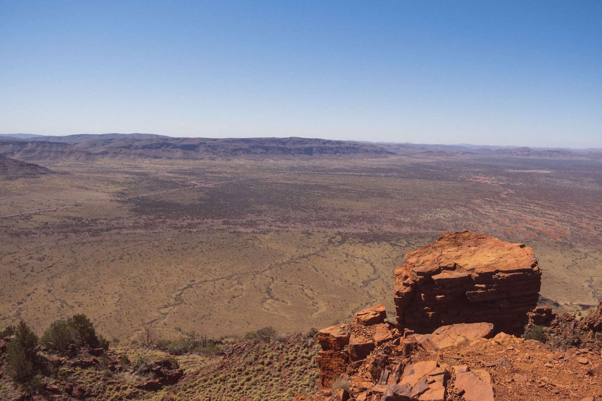
Less than two hours into the walk, we gained the summit, and the path gave way to a spectacular panorama of a sunburnt country speckled with tussock grass, wildflowers and stunted shrubs spreading towards the blazing horizon.
track details.
Start/End: Mt Bruce car park
Distance: 9km return
Time: 3 hours return (official estimate: 6 hours return)
Elevation: 565 meters (+/-) (lowest point: 745m / highest point: 1225m)
Difficulty: Class 5, difficult rating
Best time to hike: early morning or late afternoon; avoid extreme heat as the track is very exposed
Further information: Official Parks and Wildlife Service website
Karijini National Park | Australia
Hike | Loop trail | 2-4 hours
Dales Gorge and Gorge Rim Walk
Next to Dales Campground, a wonderful 5-kilometre loop track explores Dales Gorge. The Class 4 trail traces the rim to Circular Pool, then runs along the bottom of the gorge through a shady wetland area to Fortescue Falls and Fern Pool.
The combination of a varied walk with several lovely swimming holes lining the track makes this one of the most popular walks in the park. We skipped the swims, for the water was very cold, but much enjoyed the scenery.
Inside the gorge, a small stream ran across polished slabs of rock and supported lush vegetation that provided a fascinating contrast to the sunburned country at ground level. The many stately trees created the impression of wandering through an enchanted forest with flying foxes screeching in the treetops.
When we came to the end of the trail section that navigated the gorge, the path suddenly met the edge of a beautifully situated large rock pool. Across the water from us rose a natural, semi-circular amphitheatre of sorts and to the left Fortescue Falls trickled down this stack of red rocks.
The terraced slope provides beautiful ledges for sunbathing and is one of the most scenic spots in the park.
We had yet to make it to the other side though, and this proved to be the trickiest trail section, balancing across the rocks that served as stepping stones across the water and were slippery with a slimy layer of wet moss.
I guess you could also swim across, but only a few people braved the chilly water. The bottom of the gorge sees the sun only for a few hours around noon, and although daytime temperatures frequently rise above 40 degrees along the rim, the nights are surprisingly cold.
A few minutes walk further up the gorge is Fern Pool, a small but remarkably picturesque spring-fed pool framed by lots of greenery. It’s a secluded spot with more people swimming there at the time, but I expect the water is not much warmer.
This walk combines the Gorge Rim (2km return, Class 3) and Dales Gorge (2km return, Class 4) tracks that steeply descend into the gorge. Fortescue Falls (800m return, Class 3) and adjacent Fern Pool, as well as Circular Pool (800m return, Class 4), are located along these tracks, but the turnoff to Circular Pool at the bottom of the gorge was closed at the time of our visit.
track details.
Start/End: Dales camping area or Dales day-use area
Distance: 5km return
Time: 2-4 hours return
Elevation: 120 meters (+/-) (lowest point: 605m / highest point: 675m)
Difficulty: Class 4, moderately difficult rating
Best time to hike: early morning or late afternoon
Further information: Official Parks and Wildlife Service website


Karijini National Park | Australia
Hike | Out & back trail | 2-3 hours
Knox Gorge
Of all the gorges we visited in Karijini, I was most impressed by Knox Gorge and the way the horizontal cliffs encroached upon us as we moved ever deeper into the chasm. This gorge with gnarled fig trees clinging precariously to its sheer walls of crumpling red rock also reminded us most vividly of Namibia’s Naukluft Mountains.
When halfway through the walk, we came to a small lagoon, it turned out that even the climbing adventures were almost identical. The water was too deep to wade through and the only other option was tiptoeing along a narrow rock ledge a little up the wall that skirts the waterhole.
My body pressed against the wall, I had a strong sense of déjà vu as my fingers moved across the polished rock, trying to find small cracks to hold onto. All the time, I tried desperately not to think about the spiders and snakes possibly hiding in the very same crevices. Whoever is not fond of heights should bring a swimsuit.
Shortly after, the trail came to an end, where the canyon walls narrowed to a generous gap and abruptly gave way to a second gorge running at an angle to the first. No sunlight touched the gorge in which we stood, and the stone had taken on a dull reddish-brown colour, while beyond the gap the rock was still bathed in bright sunlight and glowed in brilliant, fiery shades of red. It was this glorious display of colour that made me think of a Peter Jackson movie.
Water running towards the gap spilt across the ledge into a waterfall out of sight. It was eerily quiet, apart from the soft gurgling sound that bounced off the escarpment. That little stream is the only detail that I think Jackson might change – make the waterfall run across the gap, like a curtain of fine mist obscuring the gateway to a mysterious land.
track details.
Start/End: Knox Gorge car park
Distance: 2km return
Time: 2-3 hours return
Elevation: 130 meters (+/-) (lowest point: 615m / highest point: 675m)
Difficulty: Class 5, difficult rating
Best time to hike: early morning or late afternoon
Further information: Official Parks and Wildlife Service website


