Hike | Pizol | Switzerland
Hiking Switzerland's famous Five Lakes Trail at Pizol
Text | Anninka Kraus
Photography | Tobias Kraus

Switzerland
When no rain is forecast for a weekend at the end of October the passionate hikers rush into the mountains with urgency like it were the last boarding call. A mountain call you could say, I suppose.
Tobi immediately proposed the well-known Five Lakes trail in Eastern Switzerland close to the Lichtenstein border, which sounded like a long drive from Central Switzerland initially but wasn’t – Switzerland is so tiny that even bordering countries are always close by.
The area around Pizol, a mountain massif in the Sarganserland, a region in the canton of St Gallen, rising to 2844m in elevation, is crisscrossed by a large network of hiking trails in summer – one of them the Five Lakes trail – and converts into a popular skiing area in winter.
Several lifts operate in the area, three of which lead up to Pizolhütte (a mountain hut) in individual sections, starting from Wangs. Unfortunately, when we laced our boots on in the parking lot next to the lower cable car station, the mountain range was partially shrouded in low clouds and visibility wasn’t great but we decided to give it a go anyway.
After a comfortable gondola ride from Wangs to Furt at 1522m, the chairlift taking us further up to Gaffia at 1861m was a rather chilly but exhilarating open air affair.
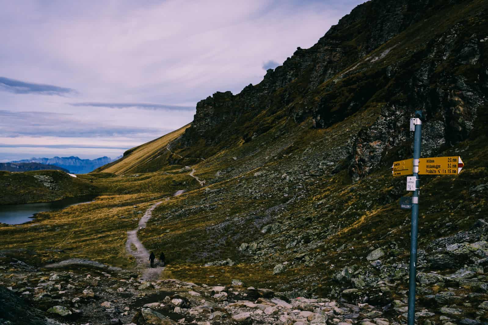
When we exited Gaffia lift station, the trailhead was well sign-posted and forked off the main path to the right after a few steps. Almost everyone continued up the mountain on the third chairlift connecting Gaffia with Pizolhütte, but for two rather chatty ladies and us who started climbing a string of switchbacks on a meadowy slope. As we were far above the tree line, in alpine grassland, we could see the rock trail briskly winding uphill through rugged alpine scenery dotted with patches of snow.
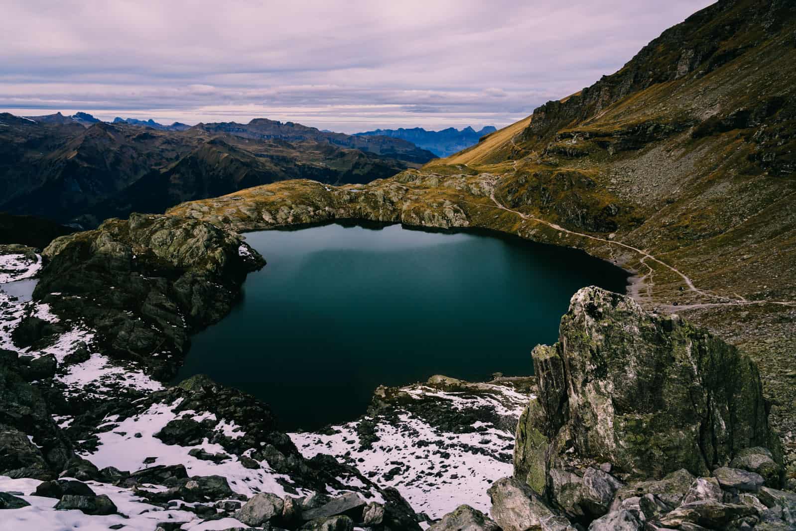
Though it was chilly we warmed up quickly with the exercise and had stripped down to a long sleeve when the first lake, Baschalvasee at 2174m came into view. Its murky green colour and position at the bottom of a debris slope with a spotty snow cover were a generous reward for the uphill climb.
This succession of a steep uphill scramble to be rewarded by views of a gorgeous lake would in fact be like a golden thread running through the hike, and after a short rest on the lakeshore another uphill scramble, across the eastern flank of Gamidaurspitz, followed. But at least the patches of baby blue sky streaked with fleecy clouds that broke through the layer of fog increased in size with that of the snowfields.
As the visibility had improved considerably when we reached the exposed and very windy summit of Rossstall at 2456m, the panorama of rows upon rows of mountain ranges and valleys stretching in all directions was spectacular. A large collection of cairns – stone slabs piled high – which the Swiss call Steinmannlis reminded me of Nepal but lacked the colourful prayer flags that brushed cheerfulness into the most barren mountain terrain on the Annapurna Circuit.
A short downhill stretch took us to Schwarzsee 2368m, the black lake that was indeed of a very dark blue colour, and up again a steepish slope to Schwarzplangg at 2505m. I believe this summit was even windier than the last but the panoramic views towards the Glarus Alps and the Swiss Tectonic Arena Sardona, a UNESCO World Heritage Site were even better in return. We had plenty of time to savour this view on our descent to 2350m and approach Schottensee at 2335m on a flat stretch skirting around its left shore.
This is where we stopped for lunch, vis-a-vis the steepest mountainside to climb yet, and just when I thought that sitting on the grass near patches of snow with the sun playing hide and seek behind the clouds was actually rather chilly we noticed a dog was in fact bathing in the lake.
No ice floes drifted on the surface but it must have been freezing cold nevertheless. The final ascent, a hard slog along switchbacks on a rocky trail covered with snow-slush was treacherous for lack of grip and I was once again thankful we were climbing up the slope not sliding down it.
The hikers staggering towards us looked less happy but all of us jumped when screeches and shouts echoed off the rock walls. Two hard-boiled crazies had jumped into Schottensee and judging by their screams they had overestimated the water temperature.
When we finally gained the last elevation Wildseelücke/Wildseelugge at 2493m, we came upon the intensely turquoise Wildsee (wild lake) and were rendered speechless. This was by far the most beautiful of the lakes, set against the backdrop of the Pizol summit and glacier and Graue Hörner, grey pinnacles fittingly called grey horns.
At a trail junction just past the lake we turned left, and knowing that we wouldn’t be punished for any elevation loss with a steep ascent later on really enjoyed the easy-going downhill stretch with views of Pizolhütte (Pizol hut) at 2227m and the last of the five lakes, Wangersee. From the hut, you can either take the chairlift back to Gaffia or walk down a gently descending field road with views of the valley.
Altogether we tackled three rather steep ascents and descents across scree slopes slippery with snow slush and alpine meadows saturated with snowmelt water but not once did I think the mountain panorama dotted with these gorgeous lakes wasn’t worth the effort.
We noticed that most hikers walked clockwise, starting out at Pizolhütte, but as I like scrambling up slippery slopes much more than sliding down them (on my butt) I preferred the anti-clockwise route with more elevation gain but less steep descents.
related.
Guide to hiking the famous Tour du Mont Blanc through Italy, France and Switzerland


Pizol | Switzerland
Hike | Loop trail | 4-6 hours
track details.
Route: Wangs via cable car to Furt – via chairlift to Gaffia – Baschalvasee – Gamidaurspitz – Schwarzsee – Schwarzplangg – Schottensee – Wildsee – Wildseeluggen – Pizolhütte (Pizol hut) – Wangersee – Gaffia
Distance: 12.6km
Time: 4 hours
Elevation gain: 960m Start/End: Gaffia (highest point: 2517m / lowest point: 1867m)