Hike | Hawke's Bay | New Zealand
Explore Te Mata Peak on the Giant Circuit
Text | Anninka Kraus
Photography | Tobias Kraus

New Zealand Hawke’s Bay
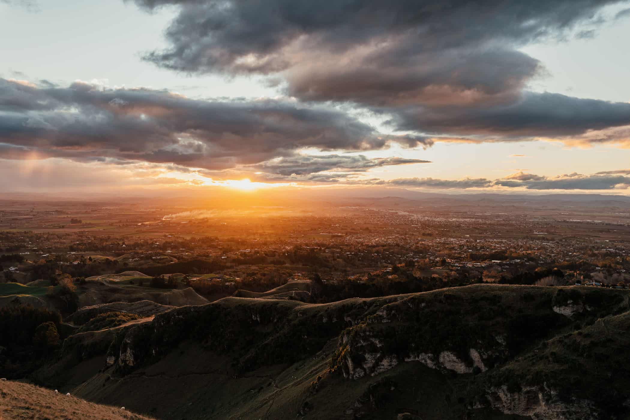
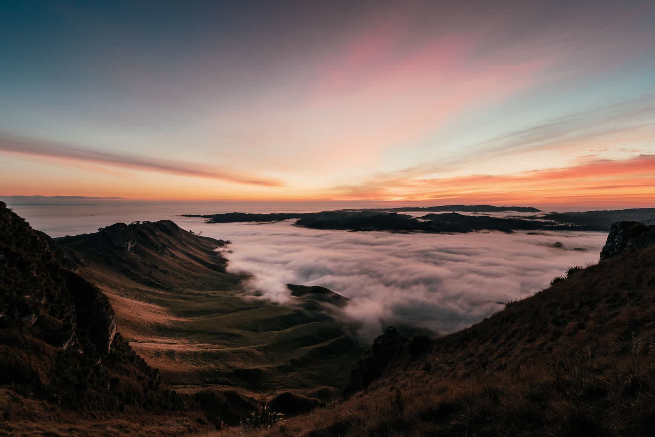
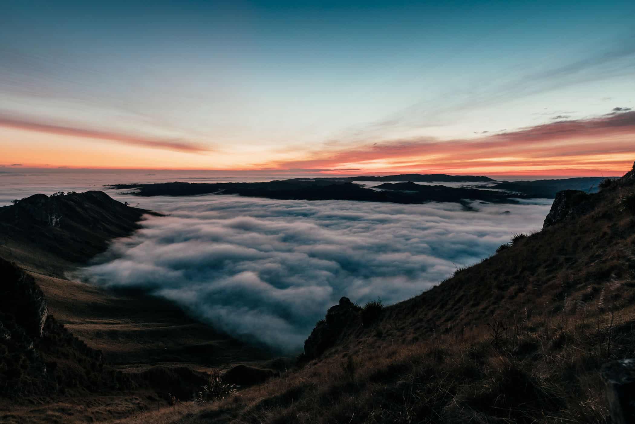
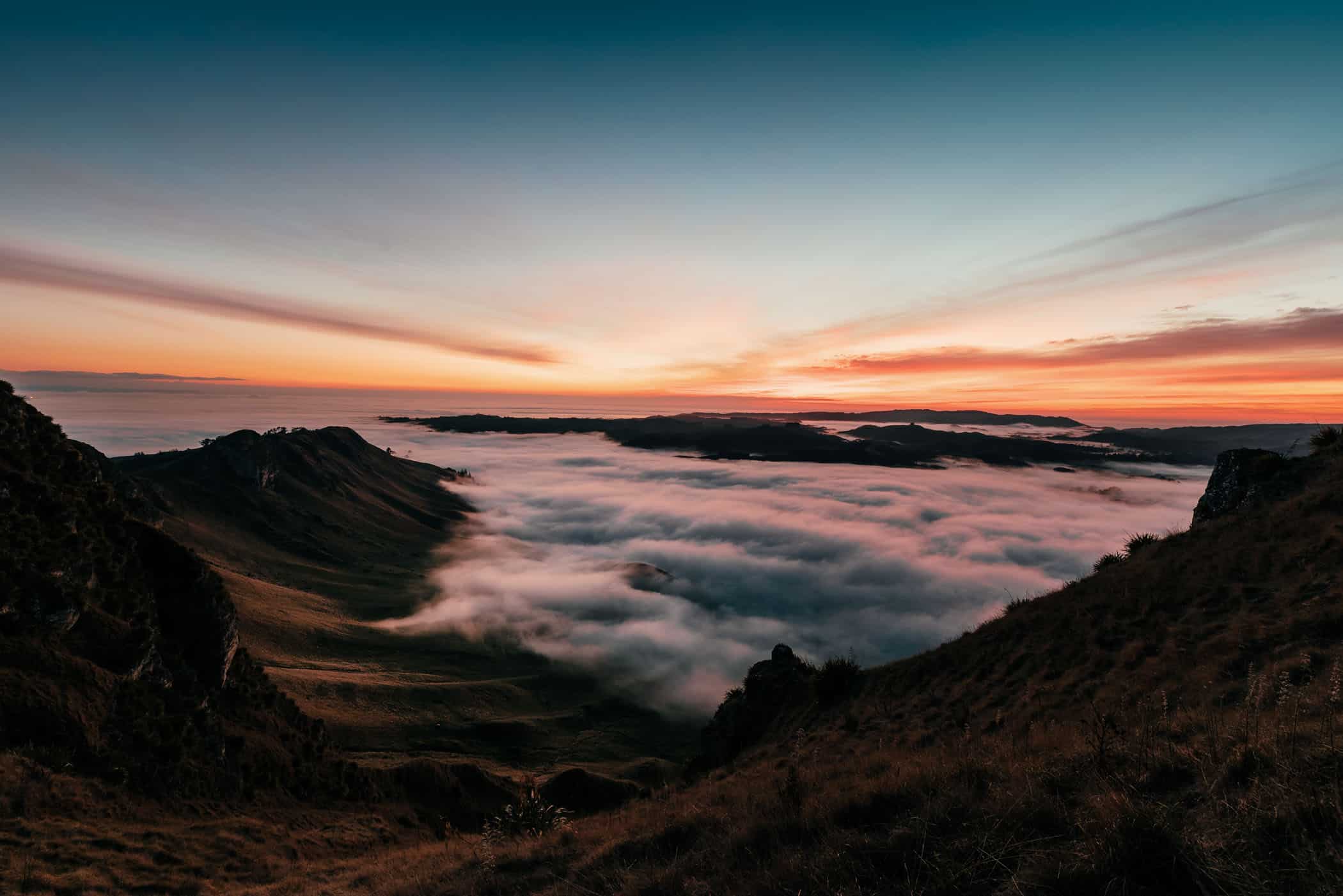
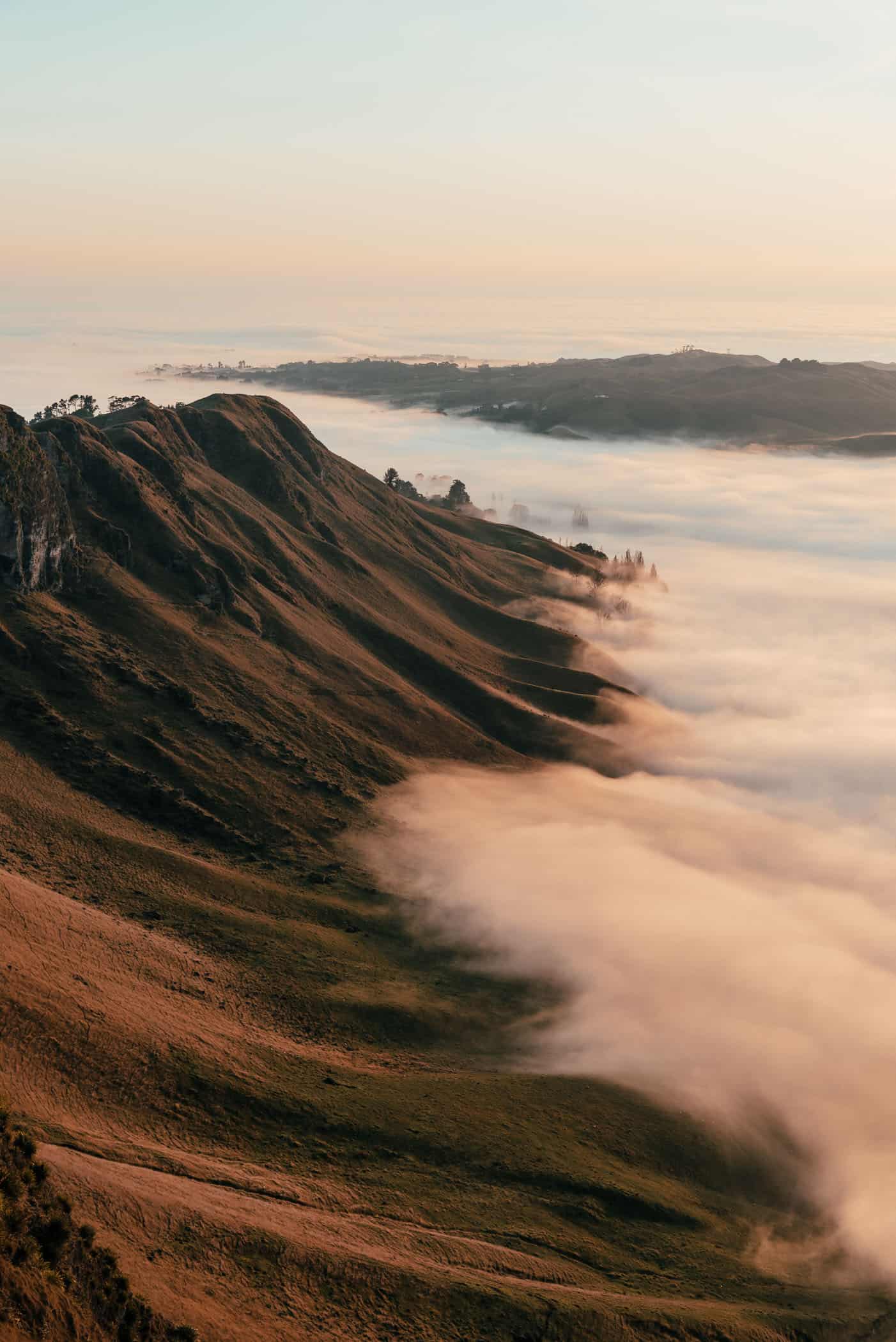
Rising to 399 metres above sea level, Te Mata Peak overlooks the Heretaunga Plains, Hawke Bay, Cape Kidnappers, and the Tukituki River snaking through jagged limestone outcrops in the Tukituki Valley.
It’s not a large mountain, but its craggy, distinct profile rising from the flat terrain is a stunning landform. At sunrise, the aerial view from Saddle Lookout over the valley to the east curving up smoothly from the river, sculpted by the varied play of light and shadow into the form of a long wave just about to break is spectacular.
The first rays of light flooding the plains throw a pale golden glow onto the curved hillside whilst still casting long shadows across the rocky spurs on the valley floor.
A sealed road winds to the top via Peak House and Saddle Lookout and several trails, starting from the Main Carpark Gates, also crisscross the park and ridge. Our favourite is the 5.3-kilometre Giant Circuit that swoops around the peak in one large circle.
After an opening stretch through native bush, the well-trodden trail sidles alongside the towering limestone ridge across farmland dotted with grazing sheep. Where the pastures meet the hills, a large grove of towering California redwoods planted in 1927 provides a shady and tranquil spot to rest but seems slightly out of place in New Zealand’s ‘fruit bowl’ region.
The next stretch is different again as you climb a string of tight switchbacks up the steep rock face on a narrow trail that is exposed and rocky at times. The uphill slog is well worth the effort for upon gaining the ridge, the long views across the plains, river valley, and the Pacific Ocean are truly outstanding.
From the summit, the track returns to the car park via Saddle Lookout and Peak House.
The loop is signposted with red markers and takes about 2 hours to complete. It’s not a technically difficult trail but steep and narrow in places.
If you prefer a shorter, less challenging option, there are four more walking trails that run through the park, but the Rongokako Trail (blue) is the only other trail that climbs to the summit.
Piwakawaka Loop – 1.3km / 40 mins
Big Redwoods Track – 2.7km / 1 hour
Karaka Wander – 4.0km / 1:15 hours
Rongokako Trail – 5.5km / 2:15 hours
related
Explore the Hawke’s Bay Cycle Trails
Cooks Cove Walkway in Tolaga Bay
where to stay & eat
Katherine’s airbnb in Havelock North
Hygge at Clifton Bay Cafe
Have a fantastic pizza at Alessandro’s
Do not miss Hawke’s Bay Farmers’ Market on Sundays
Funbuns in Hastings


Hawke's Bay | New Zealand
Hike | Loop trail | 1.5-2.5 hours
track details.
Start/End: Main Carpark Gates
Directions: the Main Gates Car Park and starting point of all trails is located a 10 minutes’ drive south-east of Havelock North on Te Mata Peak Road
Distance: 5.4km
Time: 1.5-2.5 hours (official DOC estimate: 2:15 hours)
Elevation: 310 meters (+/-) (lowest point: 155m / highest point: 399m)
Difficulty: moderate, the track is steep, narrow, and exposed in places
Best time to walk: all year
Options: the track is also suitable for trail running
Permits: none required but the car park and the upper section of Te Mata Peak Road are closed to vehicles from 10pm to 5.30am.
Further information: Official Te Mata Park Trust website