Hike | Manawatu-Wanganui | New Zealand
Hiking the Tongariro Northern Circuit (in a day)
Text | Anninka Kraus
Photography | Tobias Kraus

New Zealand Manawatu-Wanganui
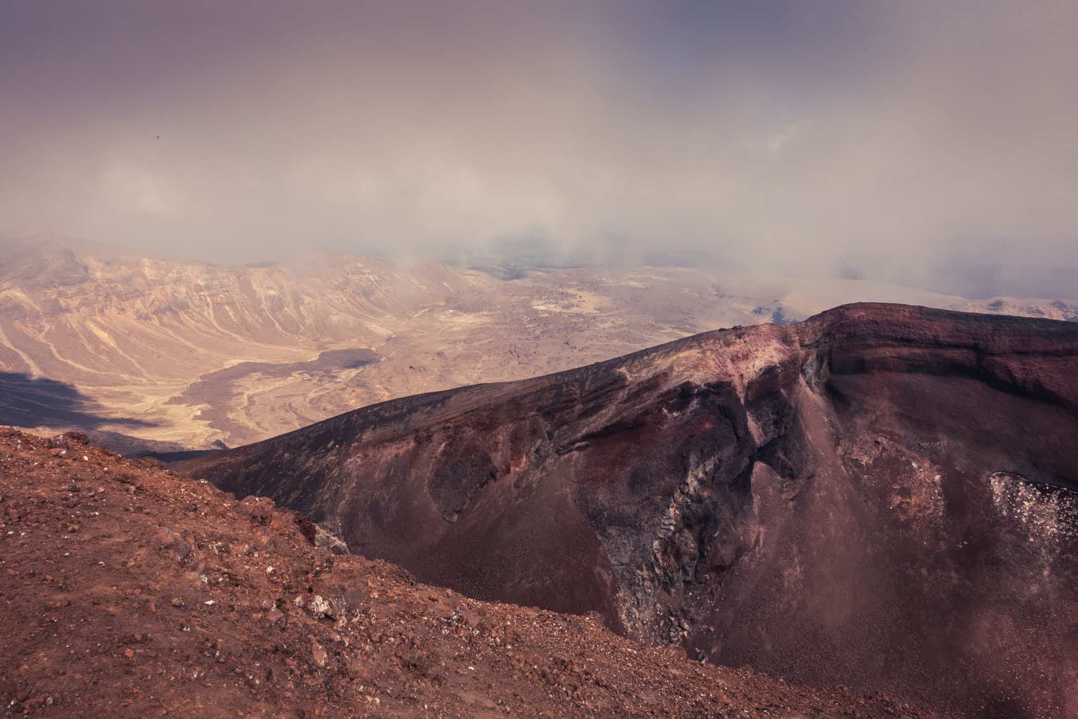
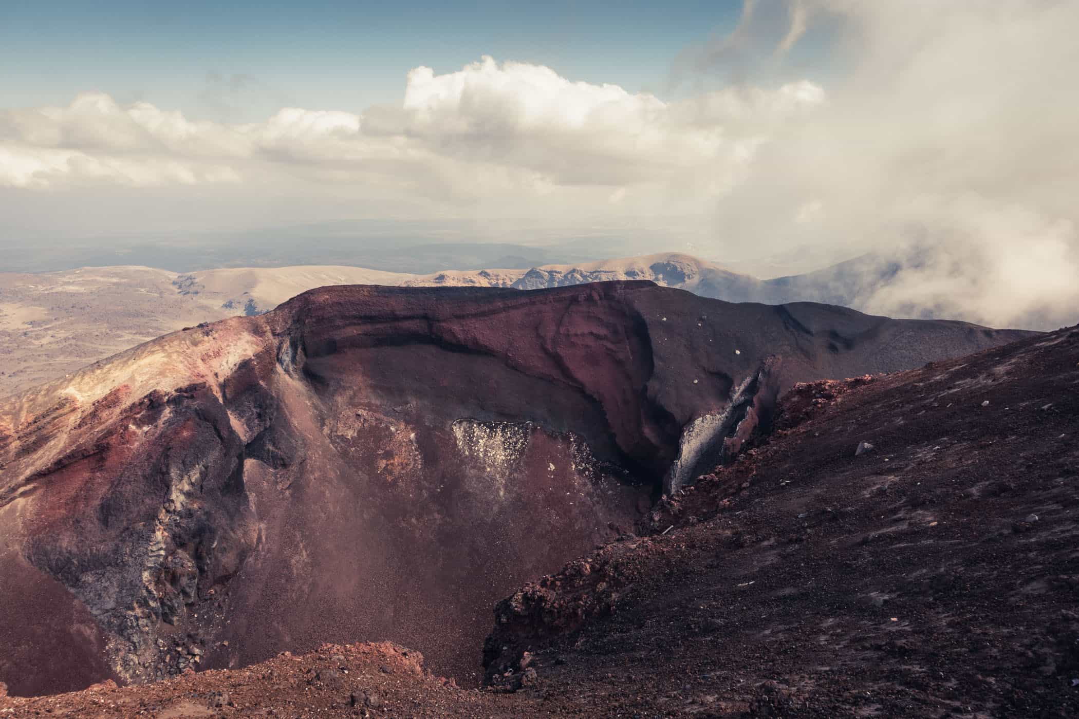
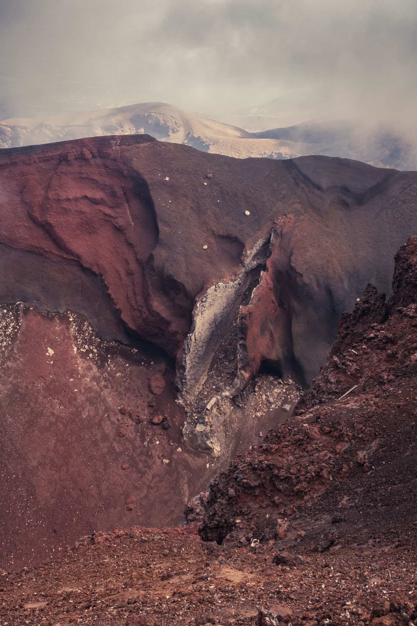
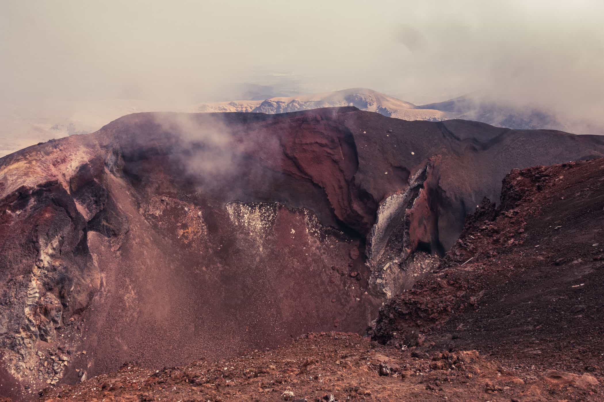
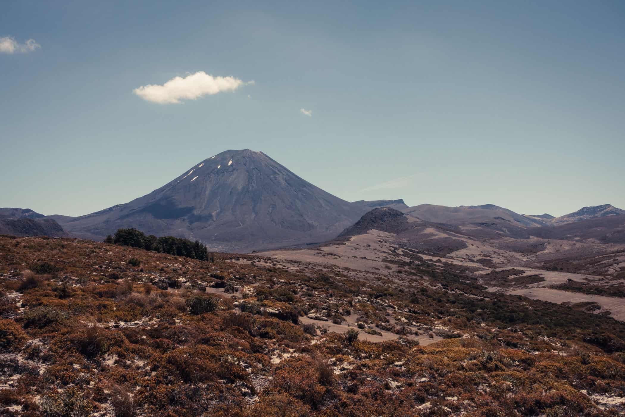
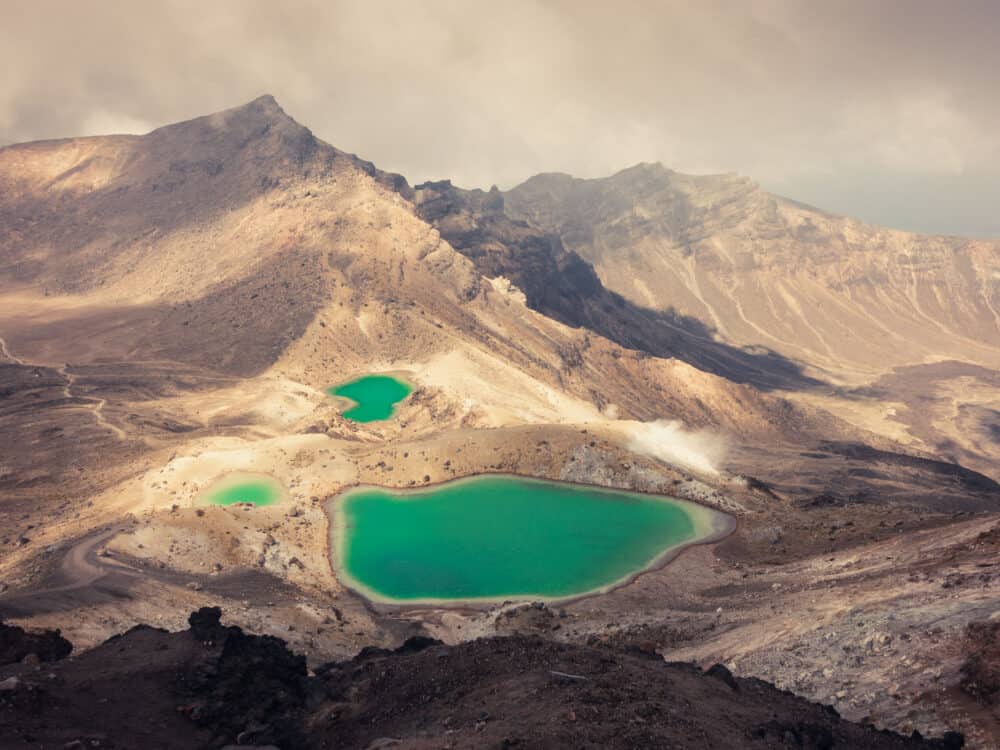
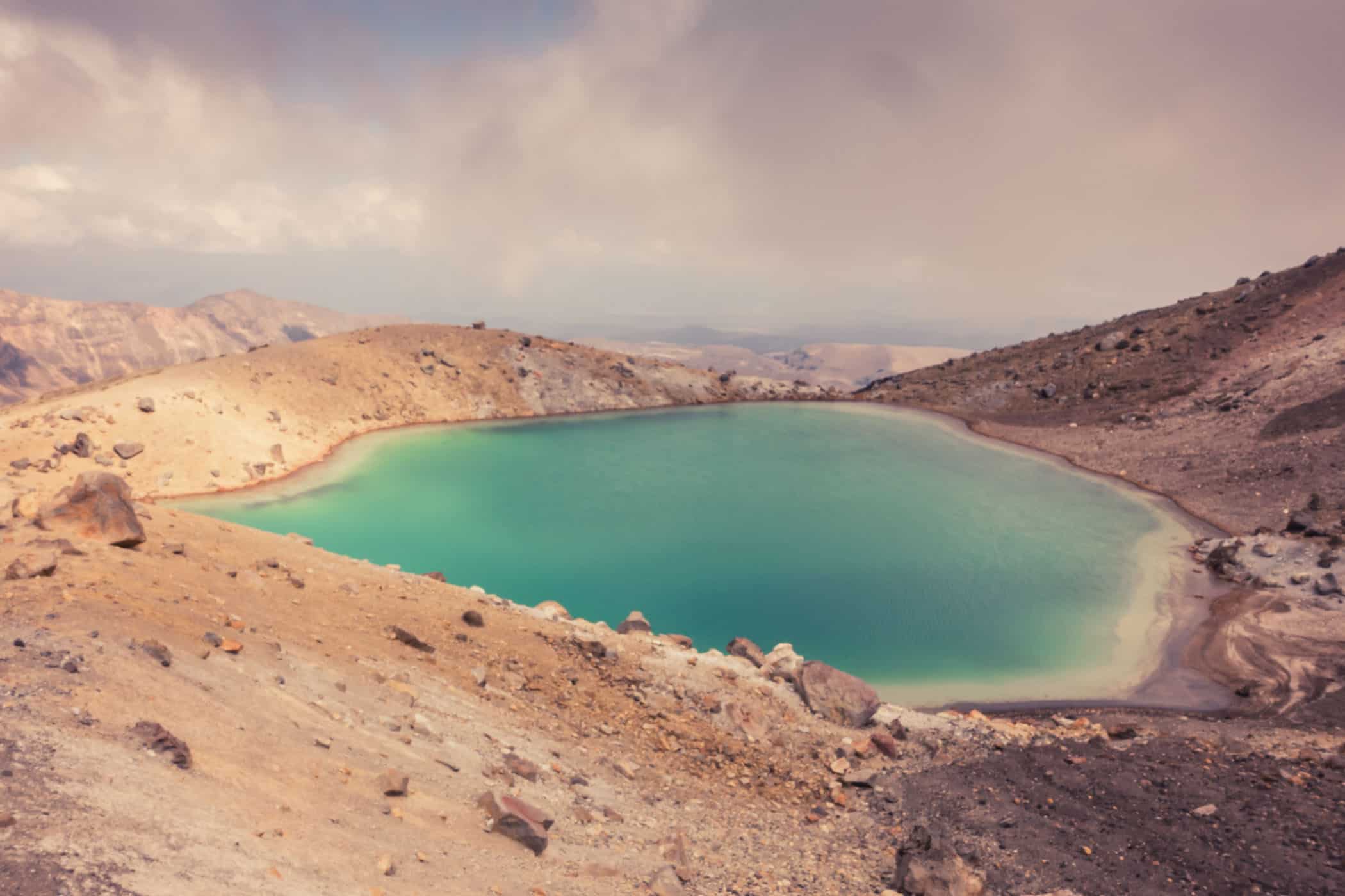
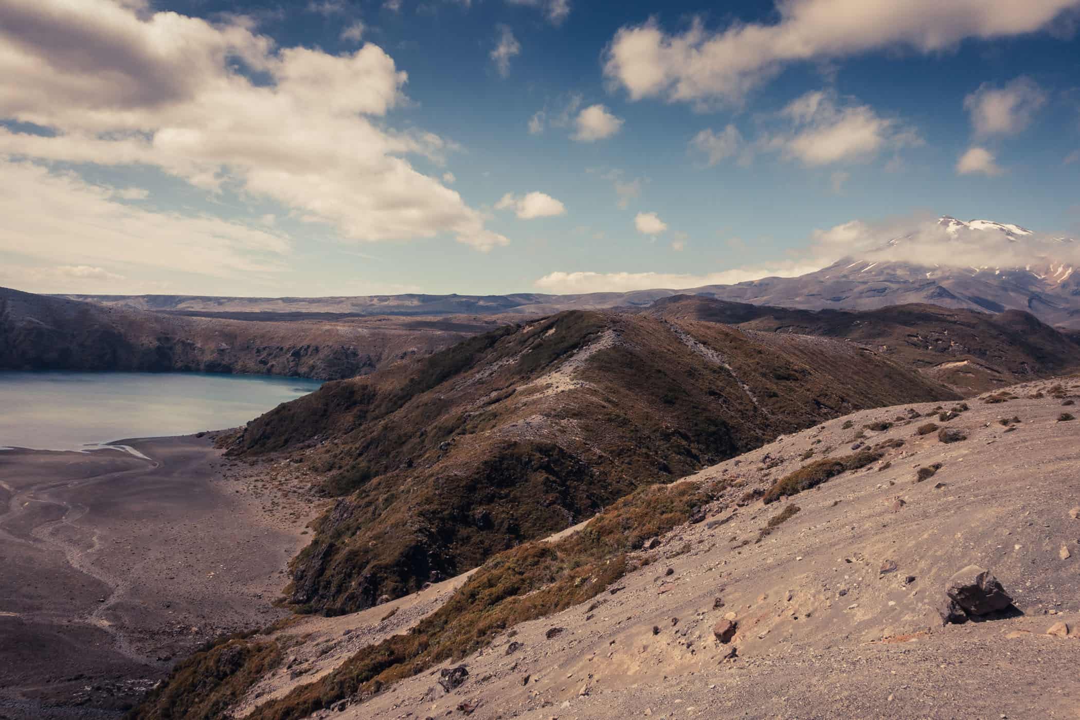
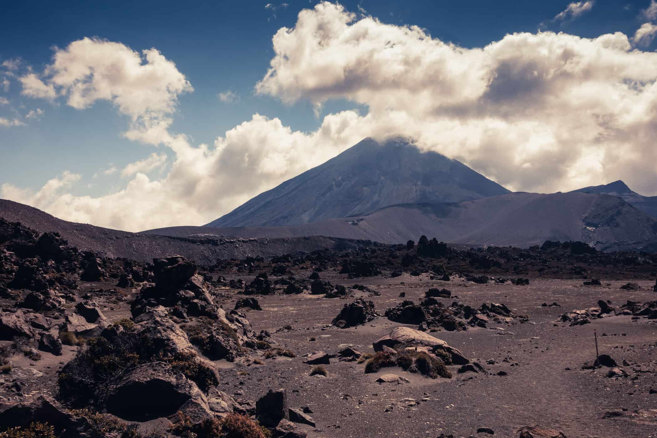
It is late afternoon when we scale the steep incline from the Oturere valley to the Emerald Lakes and start on the slippery slope of black scree to Red Crater. The sky is blackened with big patches of leaden clouds that race across the blue and fraternise into an ever-darker grey canopy between Mt Tongariro (1967m) rising in the north and Mount Ngauruhoe (2287m) to the south.
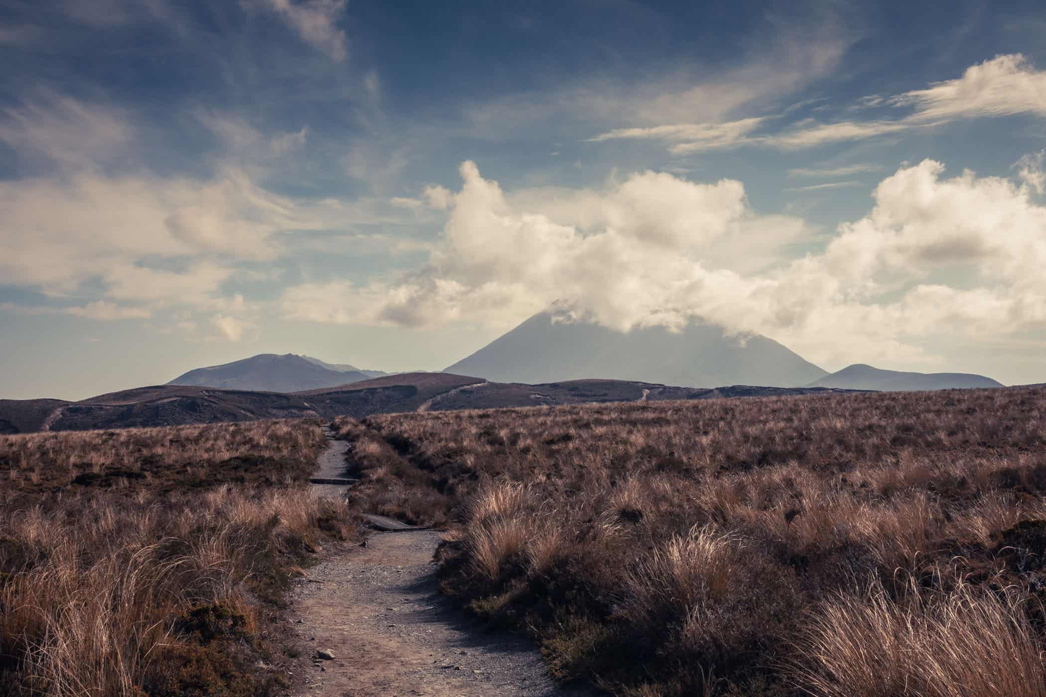
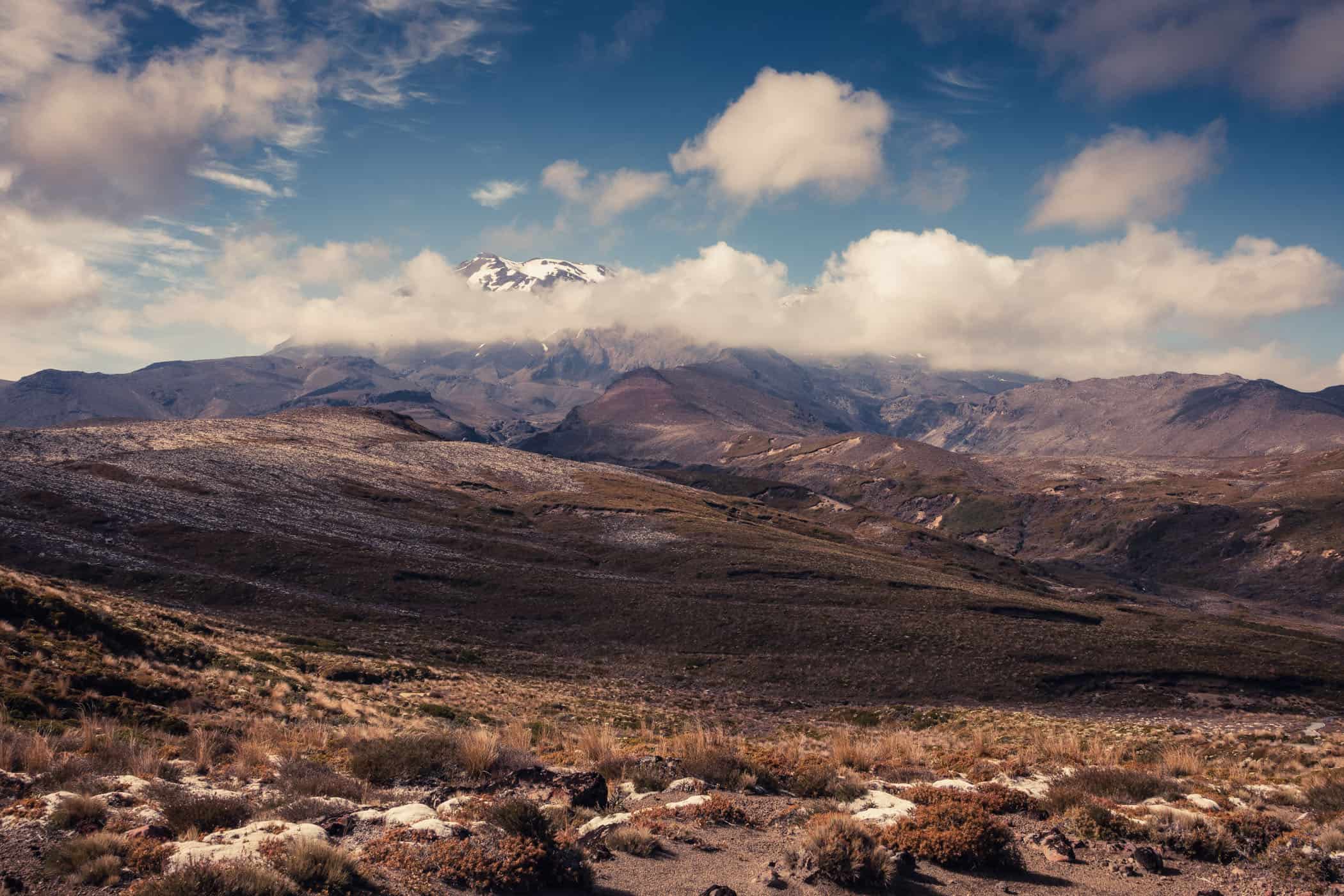
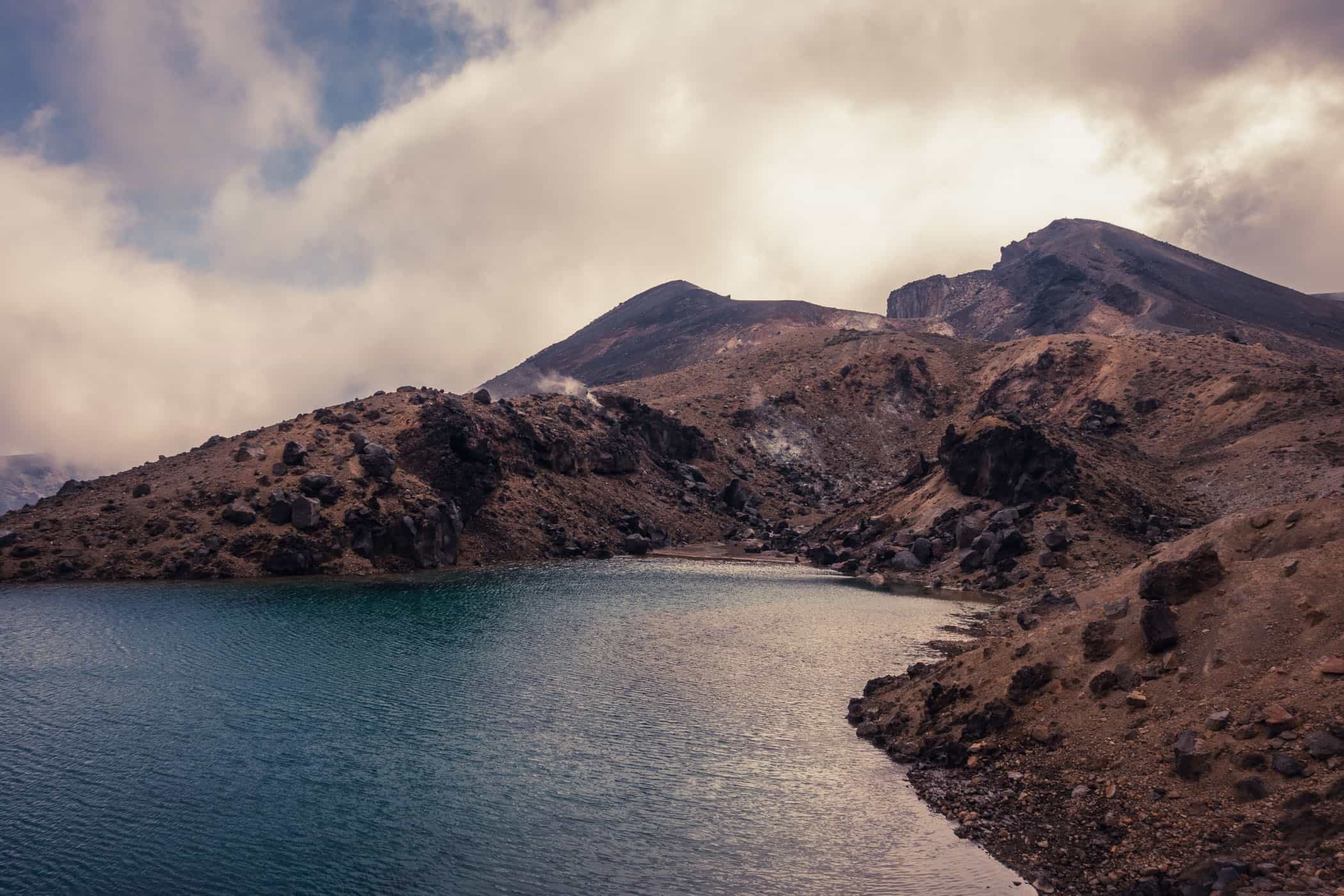
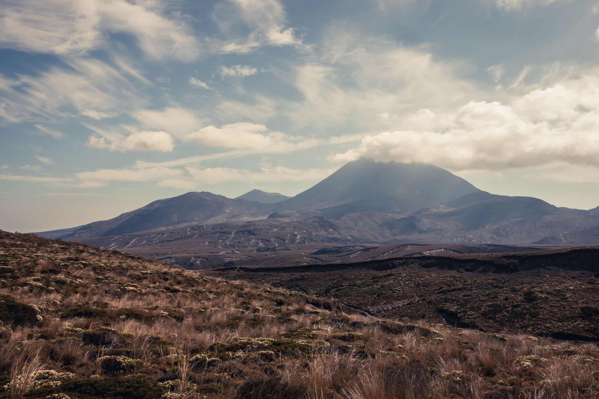
We’re on the Tongariro Northern Circuit, walking around volcanic craters and perfectly shaped cones, and across black desert plains sculpted by ancient lava flows and more recent eruptions from Ngauruhoe in 1949 and 1954. Steam vents hiss and spout where glaciers once filled the valleys.
This is Tolkien’s land of Mordor. And just like in Lord of the Rings, the menacing clouds fit this inhospitable, other-worldly place so well. A landscape so dark and barren and yet bathed in a bountiful palette of crimson reds, vivid orange hues, and dark browns.
With not another person in sight, we may well be anywhere. On Mars, or in Middle-earth. It is too late in the day for day hikers on the crossing and those walking the circuit are well settled into the huts by now.
As would we, had it not been for a crammed 26-bunk Oturere Hut, where one and a half mattresses remained for the two of us when we arrived at 3 pm with a booking for two (full-sized) adults. Spontaneously we decided to make our 2-day overnight trip into a day hike and pushed on.
Halfway to the crater rim, the slate grey canopy tears open and rays of sunlight dart across the desolate landscape like dazzling stage lights. I pause, pushing my hiking poles deep into the slippery mass of scree to steady myself on the steep incline.
A beam of sunlight falls on one of the lakes and colours it the most startling shade of turquoise. To think that amidst this desolate wasteland, in the dusky light, there’s such radiant beauty in a small lake. Slowly, two steps up, one down at best, we continue to the top.
I’d do the circuit again in one day in a heartbeat, but with a much smaller pack of course. However, unless you hike in summer on a day that is not too hot, start early to make the most of the long daylight hours and have previously hiked 45km+ with a 1375m elevation gain in a day, make this a 2-4-day trip, as recommended by the DOC.
As a day walk, the Tongariro Northern Circuit easily ranks among our ten favourite day hikes worldwide. In particular, the 20-kilometre stretch between Waihohonu Hut and Mangatepopo Hut features an astonishing lunar-like landscape as I’ve previously seen only in Tenerife. The other trail sections pale a little in comparison, but this is nevertheless New Zealand’s most unique Great Walk.
For the most part, the Tongariro Northern Circuit is a fairly easy walk, but some of the active volcanic terrain is treacherous, especially in bad weather and for this reason only suitable for experienced hikers. A few weeks after our hike, a Chinese tourist, while attempting the same track, died of hypothermia at the bottom of Red Crater after separating from her group.
Severe weather conditions with high wind speeds and extremely low temperatures are common in Tongariro even in summer and potentially fatal. With 30 to 40 people needing to be rescued here every year, hikers are strongly encouraged to turn back in bad weather.
Prepare well for this Great Walk and always check in with the DOC staff at the visitor centre in Whakapapa Village before your hike. If you prefer a shorter 20km day walk, do the Tongariro Alpine Crossing instead of the circuit.
The crossing is a point-to-point trail between the Mangatepōpō and Ketetahi road ends and passes by all of the park’s most stunning landscape features. Several tour operators offer shuttle services and guided walks, but as we haven’t used their services, I can’t make any personal recommendations.
Manawatu-Wanganui | New Zealand
Hike | Loop trail | 1-4 days
track details.
Start/End: Whakapapa Village
Route: Whakapapa Village – (Lower and Upper Tama lakes, not on the track) – Waihohonu Hut – Oturere Hut – Blue Lake (not on the track) – Red Crater – Mangatepopo Hut – Whakapapa Village
Distance: 44km (official DOC estimate: 45.2km), not including side trips to Lower and Upper Tama lakes and Blue Lake
Time: 12 hours (official DOC estimate: 3-4 days) , not including side trips to Lower Tama (20min return from track junction) and Upper Tama (1.5h return from track junction) lakes and Blue Lake (30min return from track junction)
Hiking the circuit in 1 day is possible only in summer and only if you’re comfortable hiking 45km+ in a day.
Elevation: 1375 meters (+/-) (lowest point: 1075m / highest point: 1850m)
Difficulty: moderate – advanced, exposed to the weather and steep altitude gain
Best time to hike: summer (Great Walks season, November – April); it is not recommended to walk between May and October (outside the Great Walks season) due to the avalanche risk and short daylight hours
Options: the track is also suitable for trail running | We walked in an anti-clockwise direction but either direction is fine as the trail is well marked both ways
Permits: none required but huts and campsites must be booked in advance during the Great Walks season
Further information: Official DOC information