Hike | Arizona | United States
Grandview - Tonto - Hance Creek Loop Trail (Grand Canyon)
Text | Anninka Kraus
Photography | Tobias Kraus

US Arizona
Following in the steps of copper miners, who built the Grandview Trail in 1892-93, you will see tell-tale signs of this era all along the track in the form of turquoise-colored rocks, iron ore, and rusty equipment scattered by the wayside. Also, you will probably think with admiration of those who in the day tackled this steep and twisting climb on a narrow track with anything other than just a day pack on their back.
The Grandview Trail is a very rewarding 6.0 miles (9.6 km) roundtrip to Horseshoe Mesa with 2,500 feet (760 m) elevation change. But because we love loop trails and wanted to see a little more of the canyon, we decided to combine the Grandview Trail with a section of the Tonto trail and two spur trails that intersect both Grandview and Tonto into an 18-kilometer circuit with 12000m total elevation gain.
The views are marvellous every step of the way, but the track itself is not maintained by the park and wasn’t in very good condition at the time of our visit. Eroded in some sections and washed away by landslides in others, trail conditions are certainly more challenging and technical than on the South Kaibab-Tonto-Bright Angel Loop and require backcountry hiking experience, a good level of fitness, and some route-finding skills.
From the parking lot, the packed-dirt trail drops away rapidly from the canyon’s rim, zigzagging down stone steps and cobbled trail sections. Within minutes, you will pass by some surprisingly exposed trail sections where people with a fear of heights might feel uncomfortable. If you do, I strongly recommend not walking further than Horseshoe Mesa, as the spur trails connecting the mesa with the Tonto trail are even more exposed.
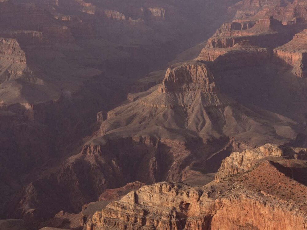
The trail remains steep throughout the Coconino Sandstone section until you reach the first viewpoint and turnaround point for most hikers on the Grandview Trail at Coconino Saddle. This is a great place to rest, with stunning views of Horseshoe Mesa and into the upper valley of Hance Creek. It’s a 2.2 miles ( 3.5km) return hike from the parking area to Coconino Saddle, with 1000 feet (305 m) elevation change.
There are some more steep switchbacks beyond the saddle, but as you approach and traverse the mesa, the trail gradually levels out with spur trails down Cottonwood Creek and Hance Creek canyons forking off before you reach a basic campground. A note of warning: There’s a restroom symbol shown on some maps, but I think most people will rather dash behind the bushes when they see what kind of primitive bucket facility with no privacy whatsoever awaits them at the campground.
Horseshoe Mesa is another good turnaround point on the Grandview Trail, making for a very rewarding half-day or day hike. The long, open views of the Grand Canyon stretching either side don’t really get much better as you descend further into the canyon, but the trail certainly becomes more difficult and is better suited to those with previous backcountry hiking experience. The track is not always obvious and a few trail markers are missing at important waypoints. Before you hike this trail, I strongly recommend you get a map at the Backcountry Information Center and download the gpx file in this post for offline use later.
From the campground, follow the trodden path that swings to the left, northwest across the mesa to a fairly steep slope and a string of tight switchbacks zigzagging over loose rocks further into the canyon. It’s a slippery descent, which will be much easier on your knees if you use hiking poles. You can pack them away again when the track reaches a junction with the Tonto Trail, a trail that runs parallel to the Colorado River, east-west across the Tonto Platform and intersects the trails descending into the canyon from the South Rim.
The trail section shared with the Tonto Trail is mostly flat and the closest you’ll come to the Colorado River on this hike – none of the inner canyon trails starting from Horseshoe Mesa descent all the way to the river. The closest access point is further east along the Tonto Trail at Hance Rapid.
The Tonto Trail section is easy, but we almost lost the trail at a wide dry streambed with no markers pointing us in the right direction. Our map led us to believe that we should continue up the streambed when, in fact, the trail continues on the opposite side of the creekbed, heading northeast before it swings back, running south. There may be a shortcut somewhere, but to be on the safe side, I’d continue on the Tonto Trail until you reach a junction with the Hance Creek Trail and a marker pointing towards Page Spring (formerly called Miner’s Spring), about 3 miles (5km) from where you first joined the Tonto Trail.
The Hance Creek Trail section starts off gently enough, but before long, you’ll face the most technical and steepest part of the entire hike, where the trail deteriorates to a faint line snaking up an almost vertical cliff face. If you love tricky climbs, you’ll be in for a real treat on the tight, steep switchbacks that scale the rock walls.
We really enjoyed this section too, but it’s quite hands-on, crawling on all fours at times. In some places, landslides appeared to have tumbled down the canyon walls, washing away all signs of a track. If you think you’ve lost the trail, retract your steps rather than try finding a different route to the top. The canyon narrows towards the top, and you don’t want to miss the track that circumvents the boulder jam when you’ve almost gained the mesa. The trail then approaches the campground from the south, passing by some old fenced-off copper mines.
From the campground, return by the same track. It’s a relentless climb to the top, so you don’t want to leave it until too late in the day.
If you’d rather walk this trail in two days and camp at Horseshoe Mesa, enquire about a backcountry camping permit at the Backcountry Information Center. Also, we skipped Page Spring, which is down a short spur track from the main trail. If you follow the route in our gpx file, it won’t take you to Page Spring, so if you want to visit there, keep your eyes open for a trail marker pointing you towards the spring.


Grand Canyon National Park | Arizona
Hike | Point-to-point trail | 5-8 hours
track details.
Start/End: Grandview Point, 19km east of Grand Canyon Village, along Desert View Drive
Distance: 17.8km
Time: 5-8 hours
Elevation: 1475 meters (+/-) (lowest point: 1145m / highest point: 2250m)
Best time to hike: early morning or late afternoon; this hike is recommended only in summer
Water: You’ll need to take plenty of water on this hike! Daytime temperatures in the canyon in summer can be brutal and there’s very little shade other than from the canyon walls. There is no potable water available along this track (Page Spring contains high arsenic levels).
Restrooms: Pit toilets are located at the trailhead, at Grandview Point.
Difficulty: challenging – rocky, exposed, and steep climbs and descents; trail markers are frequently missing at relevant trail junctions and waypoints – carry a map and download the trail’s gpx file for offline use before your hike; I’d recommend this trail only for hikers with previous backcountry hiking experience
Further information: Official National Park Service website