Hike, walk, cycle | North Canterbury | New Zealand
Guide to the best hikes, bike rides & walks in Kaikoura, Hurunui, and Waimakariri
Text | Anninka Kraus
Photography | Tobias Kraus

New Zealand Canterbury
Kaikoura, Hurunui, and Waimakariri districts are located in North Canterbury on the upper east coast of the South Island. I’ve been to the coastal town of Kaikoura, of course, some twenty plus years ago. New Zealand’s ‘whale capital’ where most people go whale watching and ‘eat crayfish’ (the town’s name is of Maori origin and translates to ‘eat crayfish’). Thank goodness we never had time for either of that.
On our family road trips down the East Coast, Kaikoura was merely a 30-minute rest stop. The idea of ‘chasing’ whales on a small boat with dozens of other tourists still doesn’t appeal to me. The idea of eating crustaceans even less. Kaikoura was never high up on my list of places to visit again, because there wasn’t much else to do; or so I thought at the time.
South of Kaikoura lies Hurunui District. Again, this is not an area I’ve spent much time in. In fact, ‘Hurunui’ didn’t mean anything to me at all and could just as well have been a Tokyo neighbourhood. Until I realized, that Hanmer Springs, Canterbury’s alpine spa village, where we celebrated Midwinter Christmas (again, that’s some 20+ years ago), is actually located in Hurunui District.
If you wonder what Midwinter Christmas might be like, I can only offer vague recollections of a rather strained get-together of Europeans desperate to recreate in New Zealand what I was happy to have left behind when we emigrated from Germany: feigned joyousness on a day that just happens to be Christmas (or worse, imaginary Midwinter Christmas) and is cold, grey, and drowned in snow slush.
And Waimakariri? My uneducated guess as to what that might be (that’s twenty years later, I’m afraid to admit): some sort of Japanese dish. Like Yakitori (chicken skewers), maybe?
All of that, needless to say, is wrong. These three districts, wedged between the Southern Alps and the Pacific Ocean are a beautiful and varied stretch of land – rugged and tranquil, mountainous and beachy, with great hiking and biking trails, and famous hot pools.
jump ahead.
Best hikes, bike rides & walks in Kaikoura, Hurunui, and Waimakariri
7-day hiking itinerary for North Canterbury
Day 1-2: Kaikoura
Walk: Kaikoura Peninsula Walkway (2-3 hours)
Cycle: Kaikoura Cycle Trail (3-4 hours)
Stay: Hapuku Lodge and Treehouses, Glenburn Coastal Retreat, or Manakau Lodge
Day 3-4: Hanmer Springs
Hike: Mt Isobel (4-5 hours)
Relax: Thermal Hot Pools and Spa in Hanmer Springs
Stay: Woodbank Park Cottages
Day 5-7: Hurunui and Waimakariri districts & Waipara Valley
Hike: there are many great hikes in Hurunui and Waimakariri districts, like Mt Grey (3-5 hours), Mt Cass (2-3 hours), or Mt Richardson (3-4 hours) tracks
Stay: Leader Valley Cottage in Ferniehurst or Kumiko’s Guest House in Waipara Valley
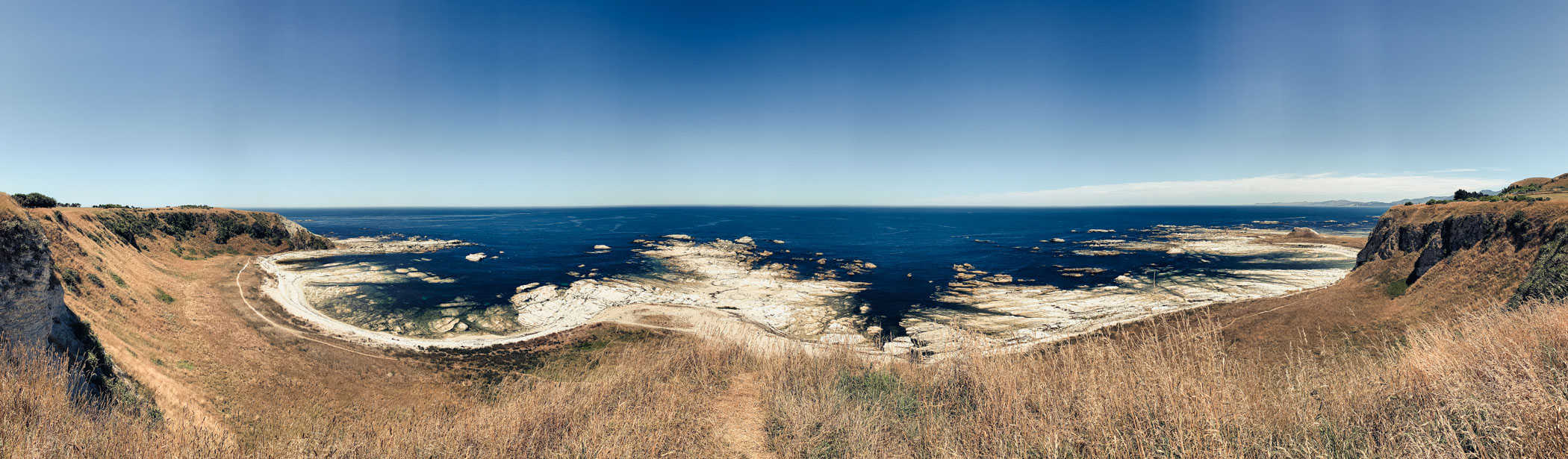
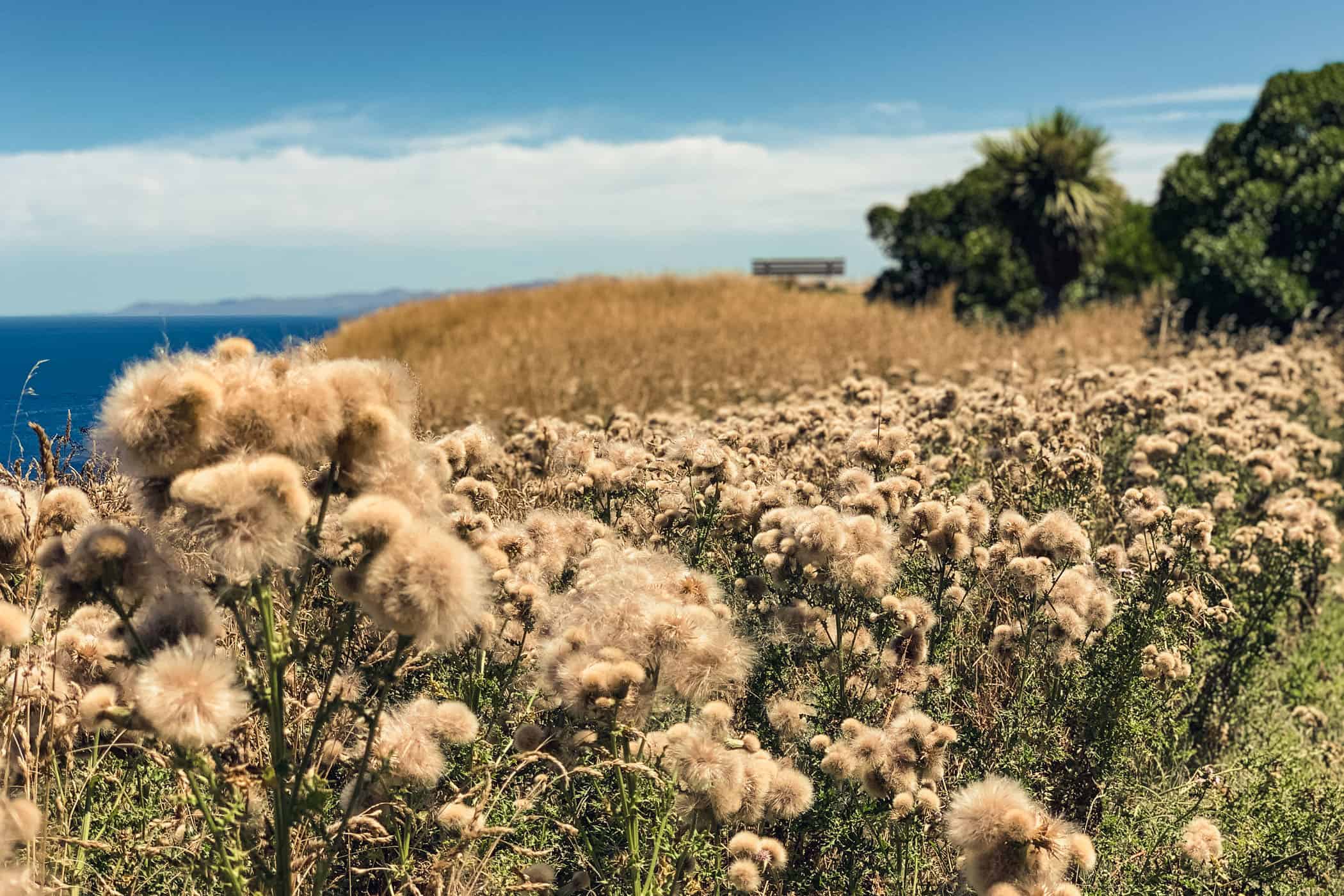
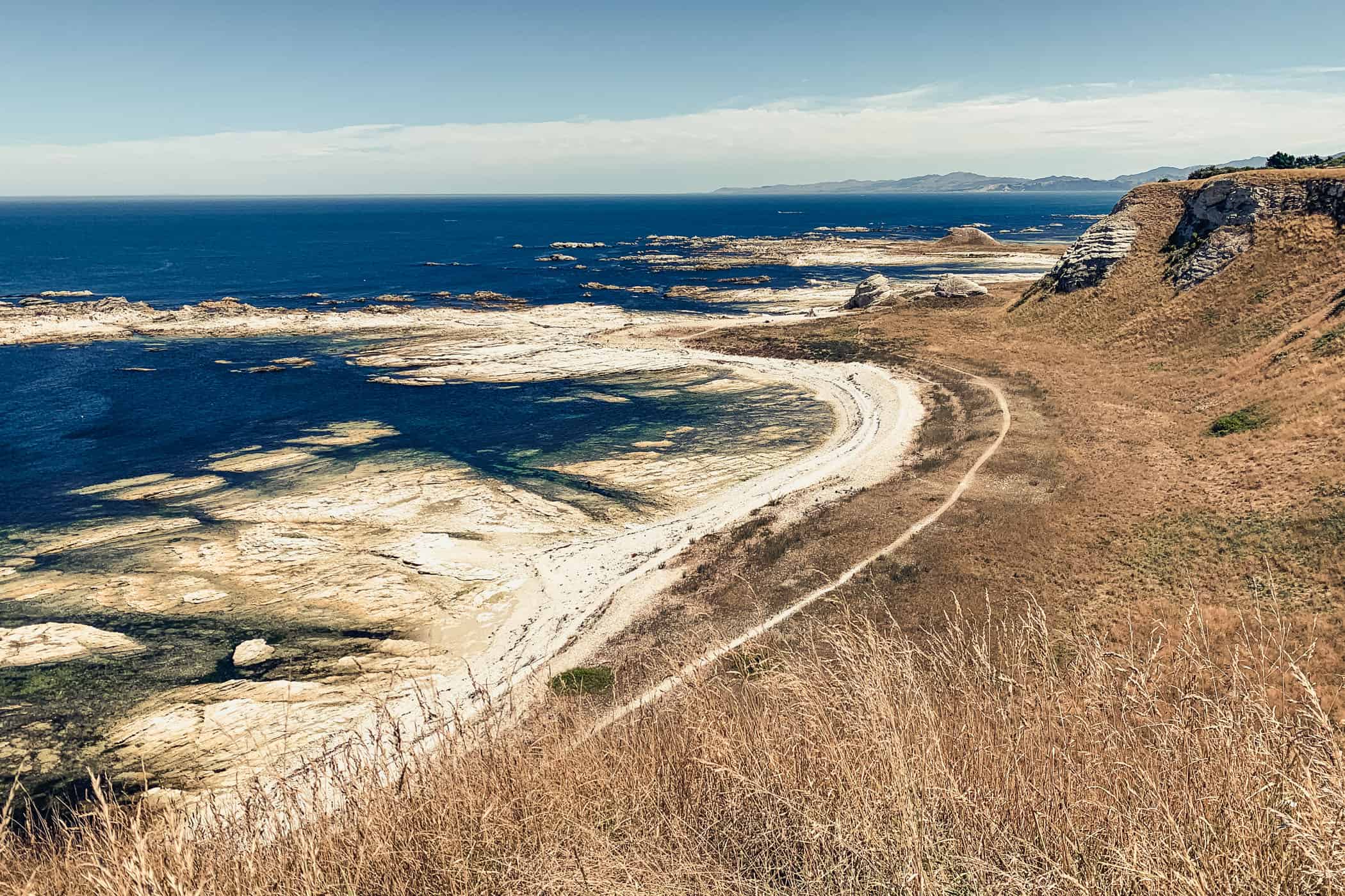


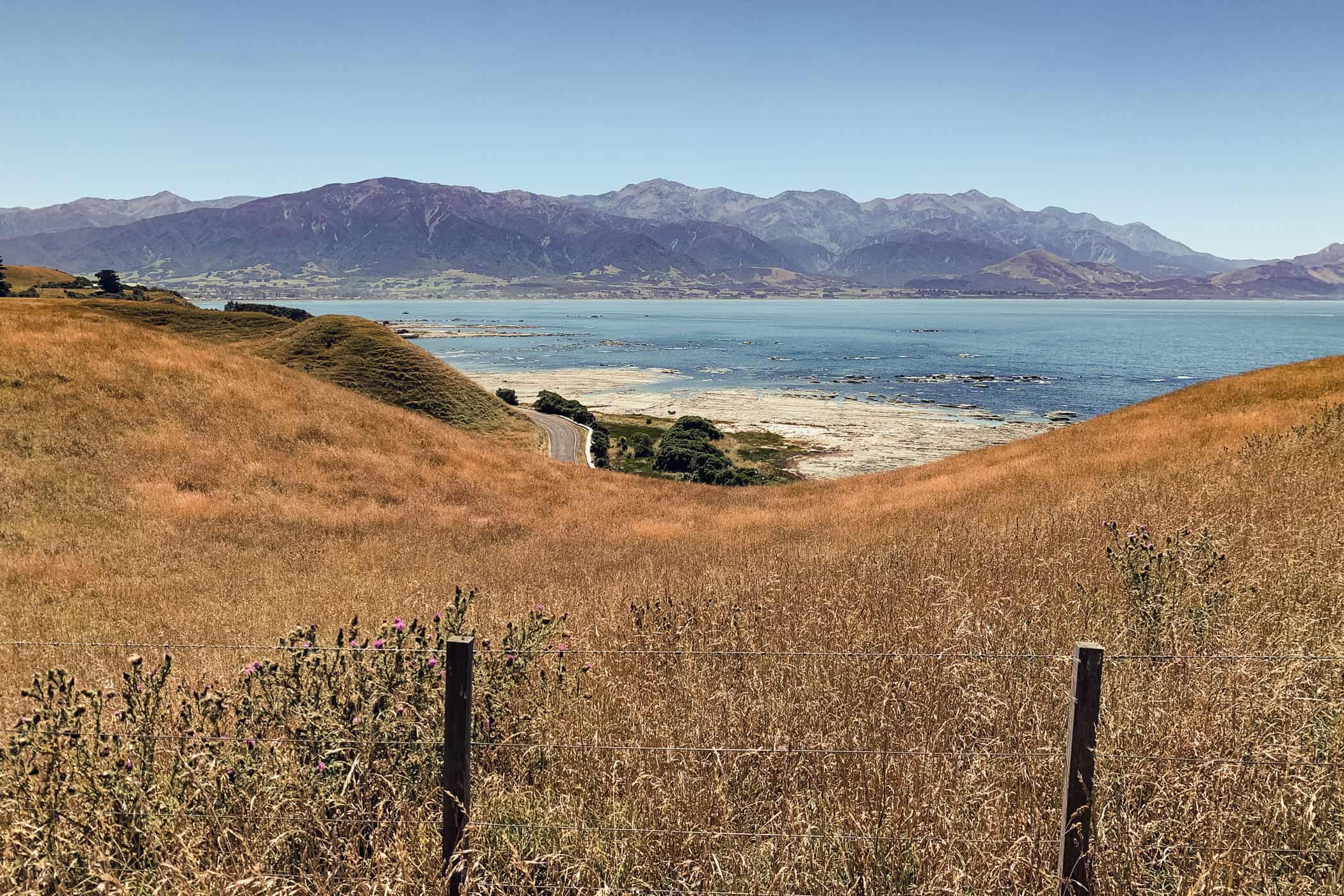
On the Kaikoura Peninsula Walkway, wheaten and blue tones dominate the scenery and the cliffs fall off steeply to the pearly white seashore revealed at low tide.
what to expect.
Kaikoura, Waimakariri, and Hurunui districts are a beautiful and varied stretch of land wedged between the Southern Alps and the Pacific Ocean– rugged and tranquil, mountainous and beachy, with great hiking and biking trails, and famous hot pools
Between Waima River outlet just south of Ward and Kaikoura, New Zealand’s longest and most important transport route SH1 doubles as one of the country’s best scenic ocean drives, sweeping breathtakingly close to the shoreline at times
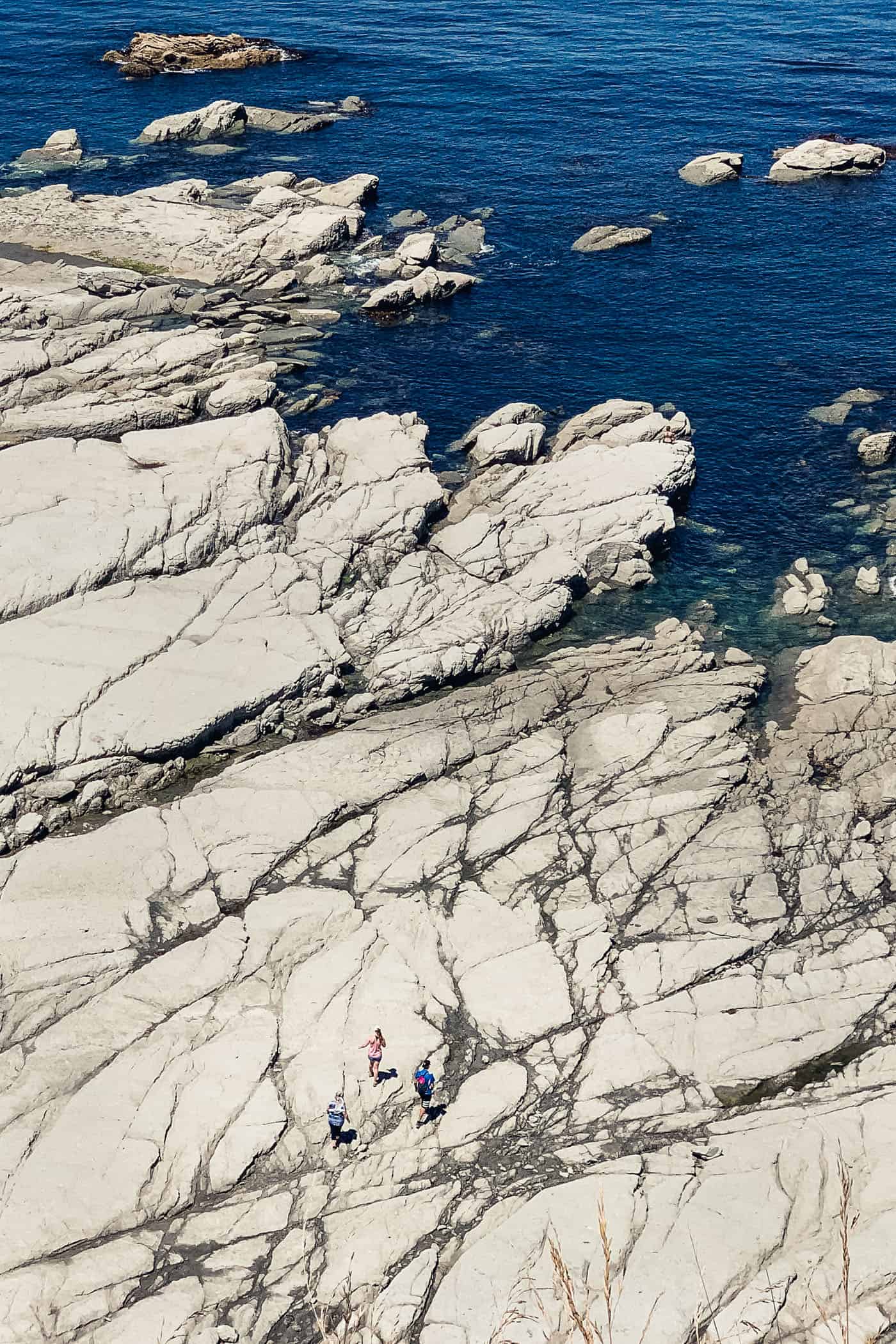
The rugged Kaikoura coastline is an adventure playground for adorable fur seal pups and easily explored on the Kaikoura Peninsula Walkway and Kaikoura Cycle Trail
Hanmer Springs beckons with 22 mineral rich thermal hot pools to soak in against a backdrop of snow-capped mountains • Great hiking and beautiful mountain scenery in the Canterbury foothills forests on Mt Richardson and Mt Oxford tracks
location & trail information.
Where & getting there: Kaikoura is situated in North Canterbury on the upper east coast of the South Island almost halfway between Picton (154 km) and Christchurch (183 km). There’s regular bus service between Christchurch and Kaikoura and the city is a stop on the Coastal Pacific railway route twice a day. The easiest way to get to Hurunui and Waimakariri districts, between Kaikoura to the north and Christchurch to the south, is by car.
Where to stay: Hapuku Lodge and Treehouses, Glenburn Coastal Retreat, and Manakau Lodge in Kaikoura, Woodbank Park Cottages in Hanmer Springs, Leader Valley Cottage in Ferniehurst, PurePods, Kumikos Guest House in Waipara
Where to eat: Restaurant No 31 in Hanmer Springs, Nom Nom Kitchen in Rangiora, The Old Kaikoura Winery Restaurant
When to go: all year
How to get around: by car because public transport options are limited
Stop & Explore: Ohau Point & Nin’s Bin: on the drive between Marlborough and Kaikoura on SH1, stop at Ohau Point to watch the fur seal colony and at Nin’s Bin for their famed crayfish | Ploughman’s Creek: For a nice stroll on a stunning black sand beach to the backdrop of steep cliffs, head to Ploughman’s Creek on Conway Flat Road, 50min south of Kaikoura. The surf is impressive and we met no one, only a seal lazing on the beach.
Further reading: Official DOC information about Canterbury’s foothills forests
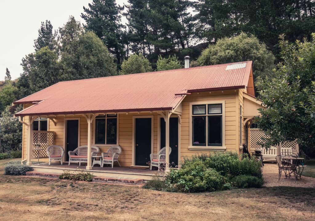
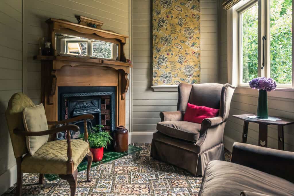
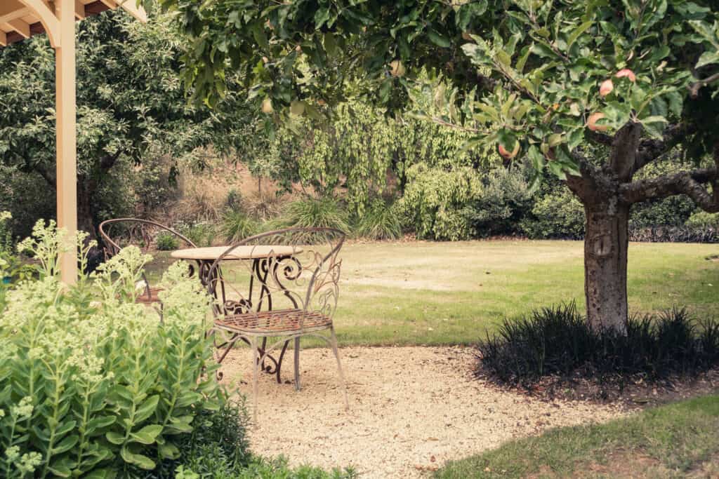
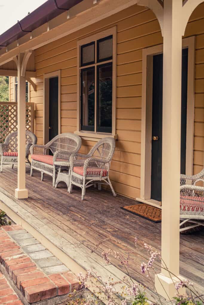
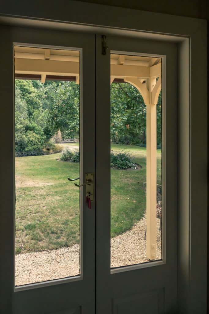
The beautifully restored Leader Valley Cottage in Ferniehurst.
The beauty of the landscape hasn't changed
Not even after a magnitude 7.8 earthquake struck near Kaikoura in 2016 and the area endured “one of the most complex earthquakes ever recorded” and the “biggest local-source tsunami recorded in New Zealand since 1947”. For weeks, the town was completely cut off with large sections of the highway and railway buried under one million cubic metres of rock and other debris.
The only way in and out were military convoys and a couple of flights.
With the severity of the damage, it was a long time before things got back to normal. Repairs of the highway north of Kaikoura took more than a year, passenger service on the railroad resumed two years after the incident. Nowadays, the only reminder of the huge damage from a visitor’s perspective are long stretches of brand new highway.
So, on the surface, nothing much has changed really, yet my appreciation of this region certainly did when we visited this time around.
From Marlborough, we drove south on SH1, down a beautiful stretch of quiet two-lane highway right on the sea. Next to the road, the Coastal Pacific railway tracks also followed every turn and twist of the shoreline. Two lines tracing the contours of the rugged Pacific coast in the little space where the Seaward Kaikoura Range runs down to a string of remote beaches and the sparkling ocean. After every turn in the road, there’s more barren rock face rising to the right, more of the same ocean and long views to a far-off horizon on the left. We cruised along and I lost track of time and distance.
Until we saw fur seals – colossal bulls and cows sprawled out in the sun and overly energetic pups – lazing, waddling, and rollicking around on the rocks at Ohau Point. The roadside car park and lookout at Ohau Point have recently reopened and arguably offer one of the country’s most accessible observation platforms to watch wild seal pups splashing about in shallow rock pools. At first glance, a car park by the highway holds little promise of an enriching wildlife experience, but as soon as we hopped out of the car, we were a part of this adventure playground for seals. The wind, the sound of waves breaking gently on the rocky outcrops, the barks and grunts of the seals, and screeching seagulls drowned out the passing traffic.
A few days later, in rural Hurunui District, south of Kaikoura, it felt as if we are the only visitors. This isn’t exactly a tourism hotspot in a normal year and sees few domestic and even fewer international guests. But with the borders closed and kids back to school, the small, quaint townships and wild beaches like Greta Valley, Motunau Beach, Gore Bay, and Cheviot were deserted. Only two places in the district were slightly busier. One was the popular Hanmer Springs Thermal Pools and Spa in Hanmer Springs village, 90min from Christchurch. The other, the North Canterbury wine region centred around Waipara Valley, 45 minutes north of Christchurch, that appeals with dozens of vineyards, cellar doors, and winery restaurants.
Further south, tiny Waimakariri District is more off the beaten track still. It generates 60% of Hurunui’s visitor spend, an estimated $93m in 2019, which is expected to have dropped to $70m in 2020 and decline even further with the impact of Covid-19. Only 4% of that revenue is spent on accommodation. It seems those who stray here on a day trip, pass right through on Inland Scenic Route 72. There really is too much competition of beautiful places in New Zealand and I can see why Waimakariri might not make it into a 3-week New Zealand itinerary. For those with a little more time however, there’s great hiking and beautiful mountain scenery to discover here, in the Canterbury foothills forests on the Mt Grey, Mt Richardson, and Mt Oxford tracks.
Walk | Loop trail | 2-3 hours
Kaikoura Pensinsula Walkway
Cycle | Loop trail | 3-4 hours
Kaikoura Cycle Trail
The Kaikoura Cycle Trail is a great way to explore more of the Kaikoura District than is visible from the highway or covered on the Kaikoura Peninsula Walkway. The 48km circuit follows the perimeter of the Kaikoura Plains on single tracks and quiet country roads and can be completed in either direction.
The Kaikoura Cycling Club that maintains the track describes the ride in clockwise direction, but we preferred biking anticlockwise with a nice, flat stretch to start with and easy finish on a downhill part. It really is up to you.
Hike | Loop trail | 4-6 hours
Mt Isobel Track
A friend of my sister’s, who lives in Christchurch, recommended we hike up the popular track to Mount Isobel for scenic views of the Hanmer Basin and once we arrived in the small township, this seemed indeed an obvious choice as Hanmer sits right at the foot of the mountain.
Hike | Loop trail | 4-6 hours
Mt Grey Track
The Mt Grey Track is a rewarding hiking and trail running track in the Canterbury foothills forests, 19kms west of Amberley, and can be joined with the Red Beech Track into a round trip.
Starting at the Grey River picnic area in Mt Grey/Maukatere Conservation Area, the well-formed track climbs steadily to the tree line on a lovely string of short switchbacks through native bush and pine and offers fantastic views from the summit.
Hike | Loop trail | 2-3 hours
Mt Cass Walkway
Some might dismiss Mt Cass Walkway in Waipara Valley, 15min north of Amberley, as too easy, too accessible, not wilderness enough.
And it’s true. The 7km track is well-formed, mostly 4WD. It’s impossible to get lost. You’ll most likely run into locals walking this mountain for daily exercise. There’s nothing daring, back-country, or difficult about this loop walk to the summit of an unprepossessing 525m-high hill. Families with small kids will probably manage just fine. Whoever revels in knee-deep mud will be disappointed. Those out for a pretty walk across farmland with remarkable views however won’t.
Making our way uphill, I was thinking that if this walk were a business venture, the ROI would be very high indeed. Invest a 3km detour off SH1 and a one hour climb on wide farm tracks passing by an old limestone quarry to the summit and be almost instantly rewarded with sweeping views to the northwest over the Waipara Valley vineyards to the backdrop of wavy hillocks and in the distance the Southern Alps. To the south lies crescent-shaped Pegasus Bay, a beautiful thin sliver of turquoise water and white sand flowing in a great sweep towards Christchurch city and the Banks Peninsula.
At the loop track junction after 1.3km, the more leisurely route to the summit forks off to the right, the steeper path to the left. We went left, but it makes little difference in which direction you walk. It’s a gentle walk all around and the elevation profile is almost symmetrical.
track details.
Start/End: car park on Mt Cass Road, 15min north of Amberley
Directions: from Amberley, head north on SH1 for 10km, then turn right onto Mt Cass Road; after 3.3km you’ll arrive at the car park and trail head on your left
Distance: 7.3km
Time: 2 hours return (official estimate: 3 hours return)
Elevation gain: 390m (lowest point: 110m / highest point: 500m)
Difficulty: easy, family-friendly
Best time to walk: opening hours are Spring-Summer, 1 November to 31 March, 8am to 6pm | Autumn-Winter, 1 April to 31 July, 8am to 4pm
Permits: none required
Options: suitable for trail running
Further information: Mt Cass Walkway passes through privately owned farmland and is closed in lambing and calving seasons, from 1 August to 30 October
Hike | Loop trail | 4-6 hours
Mt Richardson Track
Mt Richardson Track is located in the Mount Thomas Forest Conservation Area in Canterbury’s foothills forests, 65km north-west of Christchurch.
At 1047m, Mt Richardson is a little higher than Mt Grey in neighbouring Hurunui District, but can still easily be climbed on a half-day loop trail by linking the Richardson, Bypass, and Blowhard tracks to make a circuit.