Hike | Taranaki | New Zealand
The Kamahi Loop Track in an enchanting 'Goblin Forest'
Text | Anninka Kraus
Photography | Tobias Kraus

New Zealand Taranaki
The Kamahi Loop Track is a leisurely 15 to 30-minute stroll through an enchanting ‘Goblin Forest’ on the lower eastern slope of Mt Taranaki.
It is one of the few walks you’ll want to do on a rainy day because in bright sunshine some of the magical atmosphere will be lost.
Luckily, Egmont National Park has immense annual rainfall and the chances of an awfully bright day in the park are low.
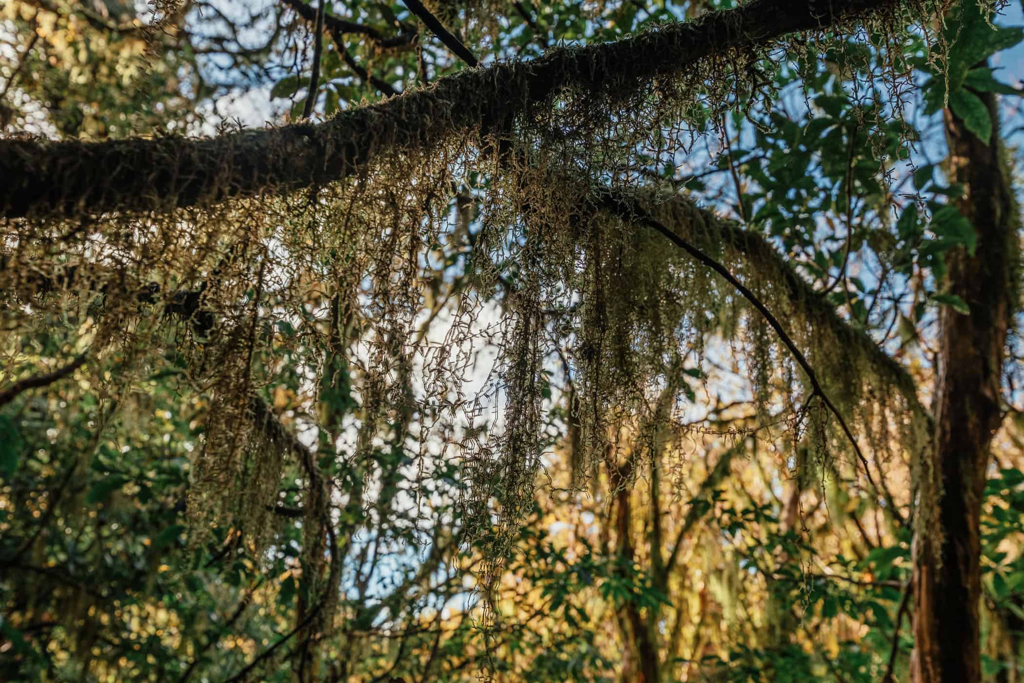
Certainly, you don’t want to be outside in a heavy downpour, but a persistent grey drizzle with thick wafts of heavy mist clinging to the native kamahi rainforest canopy will do nicely.
You’ll also want to go late in the day when the light turns sickly underneath a leaden cloud cover, yet enough daylight remains to make out the fine strands of pale lichen that are bunched up into fuzzy balls or flowing from the treetops like a delicate curtain bedecked with heavy raindrops.
The forest floor will be soft and soaked with rain and give off a sweet earthy scent. And you’ll be surrounded by stately kamahi trees, their trunks and branches gnarled and twisted into grotesque shapes, clothed in a thick blanket of moss. Navigating this maze, the trail winds and turns through a lush understorey of fern and vines that may just be home to goblins.
Alternatives walks from Dawson Falls Lodge: Walk to Wilkies Pools, several lava-formed rock pools and small, gushing waterfalls (1 hr 20 min round-trip) or to Dawson Falls (20 minutes return walk), or combine the two into a 3.7km loop trail.
related
Walk to the Pouakai Tarns where all the famous reflection shots of Mount Taranaki are taken
A stunning, award-winning seaside promenade that makes for wonderful walks and runs along the oceanfront.


Taranaki | New Zealand
Hike | Loop trail | 15-30 minutes
track details.
Start/End: Stratford Mountain House
Directions: from New Plymouth, head south on SH3, turn right onto Monmouth Road and turn right again onto Pembroke Road to Stratford Mountain House
Distance: 0.6km
Time: 15-30 minutes
Elevation: 25 meters (+/-) (lowest point: 845m / highest point: 870m)
Difficulty: easy
Best time to walk: all year
Further information: Official DOC information