Hike & walk | Marlborough Region | New Zealand
Travel Guide to Marlborough's best hikes & walks
Text | Anninka Kraus
Photography | Tobias Kraus

New Zealand Marlborough
The Marlborough region in the northeast of the South Island is a geographically very diverse landscape, stretching from the sea-drowned valleys of the Marlborough Sounds in the north, home to some of New Zealand’s best coastal walks, to the high country of Molesworth and New Zealand’s largest high-country station, Molesworth Station, in the south.
In between, the sheltered Wairau Plain is beleaguered by ridgelines on three sides and spoiled with more sunshine hours than almost anywhere else in New Zealand. Thus pampered, it produces the world-famous Sauvignon Blanc.
Visitors arriving on the Interislander Cook Strait Ferry from the North Island disembark in Picton, at the southern end of Queen Charlotte Sound, and thus inevitably spend some time in Marlborough, even if only passing through. Yet, considering how far the earliest European to fall in love with the Sound’s inlets, peninsulas, and islands travelled, the Marlborough Region and its many beautiful hiking trails that blatantly flaunt the beauty of the dark green coastal forest and deep blue waterways deserve a lengthy visit.
That European was Captain James Cook of course. On five consecutive visits to the Sounds in the 1770s, he spent 105 days, roughly a third of his time exploring and mapping New Zealand’s coastline, in Ship Cove, the starting point of the Queen Charlotte Track. It was also he, who named the track for Britain’s Queen Charlotte, wife of the British monarch George III, and lent his name to Cook Strait separating the North and South Islands of New Zealand.
related.
Cycle the 132km West Coast Wilderness Trail
jump ahead.


The sparkling turquoise waterways and lush coastal forests on the Queen Charlotte Track.
what to expect.
Sparkling turquoise waters and white sandy bays that shimmer vibrantly through dark green foliage in the Marlborough Sounds
Hike through native bush, closely tracing the shoreline deep in the sparsely populated Sounds on the Queen Charlotte Track, one of the world’s best multi-day coastal walks
World famous, award winning Sauvignon Blanc and an abundance of vineyards and cellar rooms in the Wairau Valley
Green vine stretching in long, neat rows across the Wairau Plain, from mountain ranges rising in the south to those towering in the north
A hilly landscape covered everywhere in parched long grass underneath a watery blue sky is your scenery on the Wairau Lagoon Walkway and Barrack Farm Walk
location & trail information.
Where & getting there: The Marlborough region is located in the northeast of the South Island, bordering the Nelson Tasman region to the west and the Kaikoura and Hurunui districts to the south.
Its main cities include: Blenheim, gateway to the Marlborough wine growing region, Picton, a picturesque port town in the heart of the Marlborough Sounds that connects the South Island with ferries across Cook Strait to the North Island, and Havelock, a small town 20min from Anakiwa at the entrance of Queen Charlotte Sound.
To explore more of the South Island starting from Blenheim, you have three options: take State Highway 6 towards Nelson/Tasman (1:40 hours to Nelson), State Highway 63 through the Wairau Valley towards Nelson Lake National Park (1:15 hours to St Arnaud), or drive south on State Highway 1 towards Kaikoura/Hurunui (1:35 hours to Kaikoura) and further on to Christchurch (4 hours)
When to go: the best time to visit is in summer and autumn (Dec-April)
How to get around: by car as public transport options are limited | water taxis operate in the Sounds and private shuttle companies provide transport to hiking tracks in the area.
How to prepare: especially during the summer months, it pays off to book the water taxi, luggage transfers, and accommodation on the Queen Charlotte Track well in advance
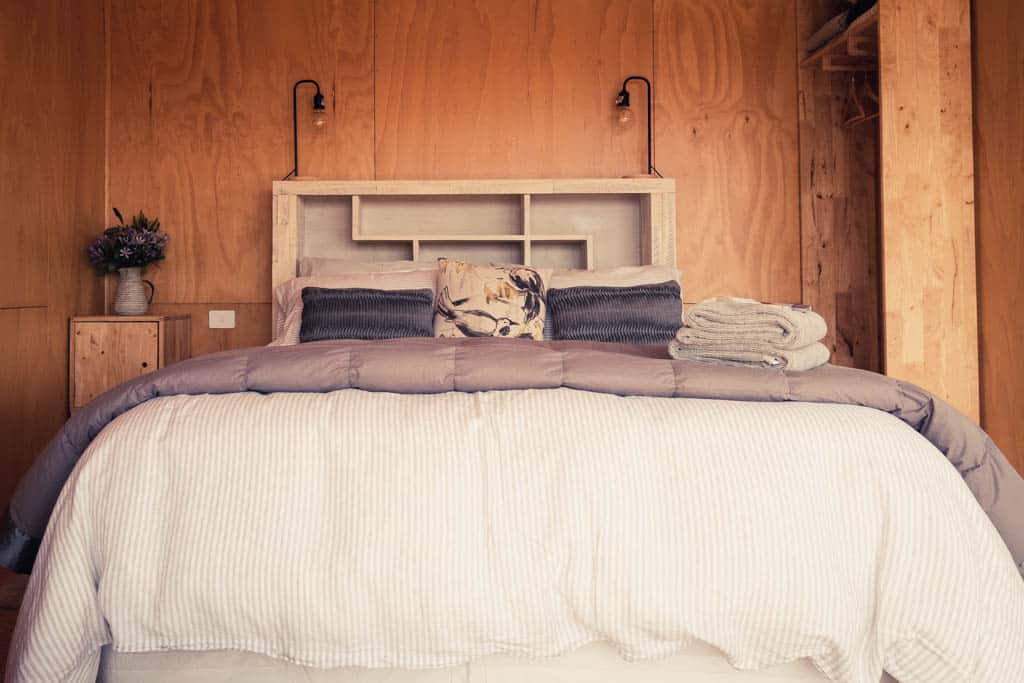
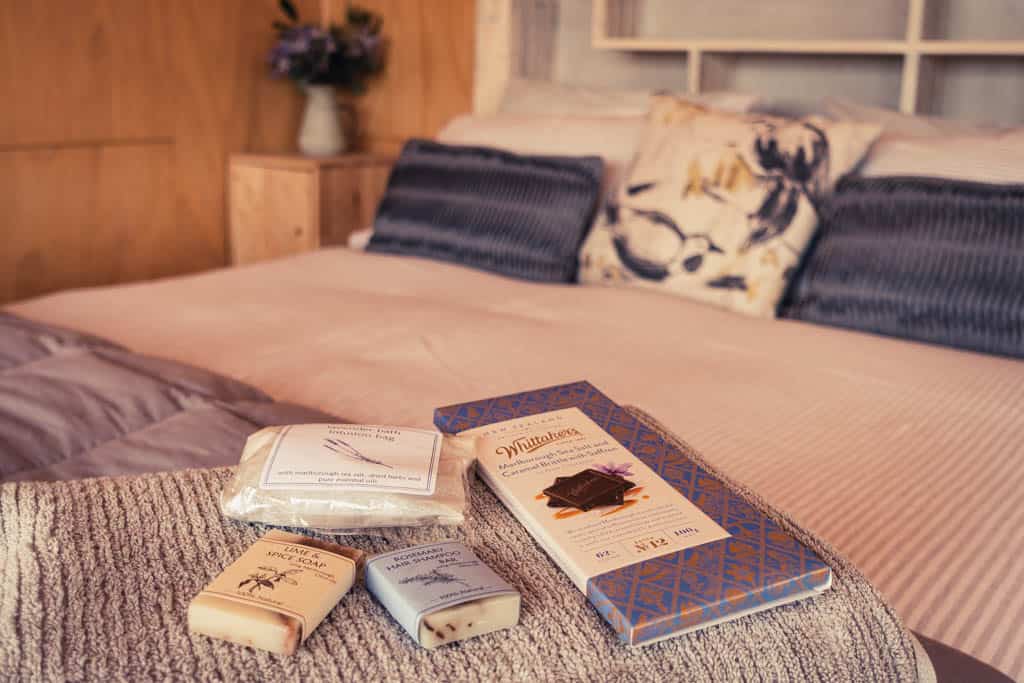
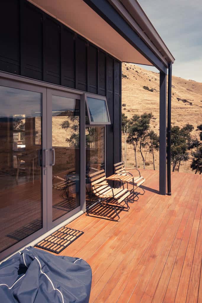
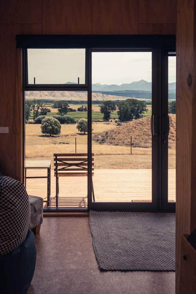
Relax at Omaka Valley Hut, one of our favorite off-grid cabins in the whole of New Zealand, 20min from Blenheim
There's so much beauty in the Marlborough wine region with lush vine running the width of the Wairau Plains in neat, orderly lines in between hills covered everywhere in grass the color of oatmeal.
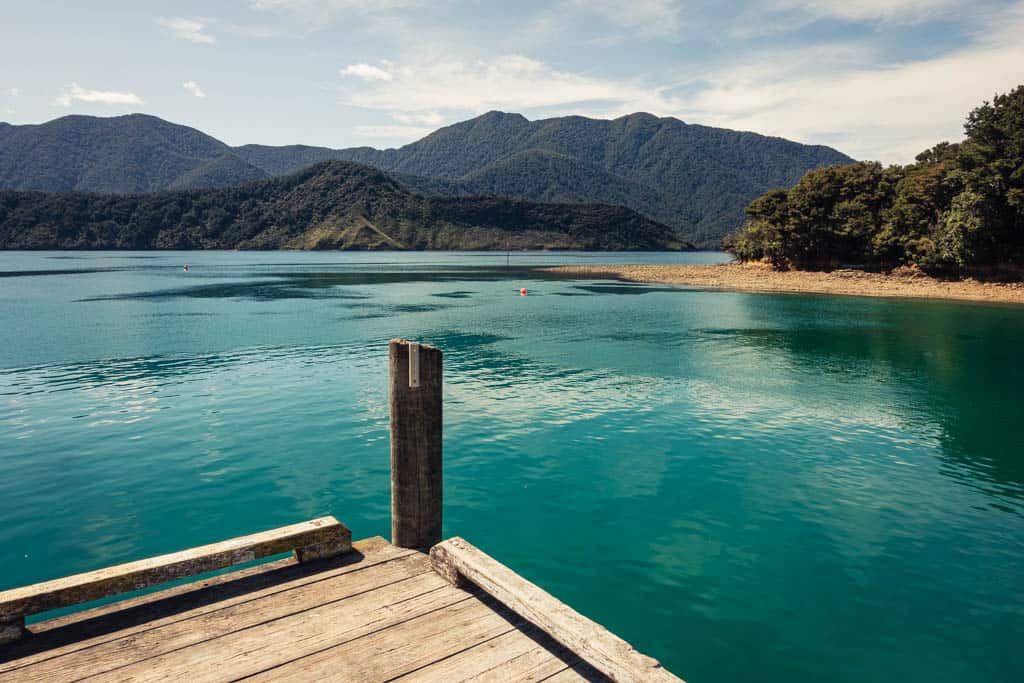
At the region’s north-easternmost end, the Marlborough Sounds cover some 4,000 km2 between Tasman Bay in the west and Cloudy Bay near Blenheim in the south-east. They were once part of the mountain massif forming the Richmond Ranges when the landscape changed considerably at the end of the last ice age some 14000 years ago. Rising sea levels and land subsidence drowned the coastal valleys and created the beautiful Sounds with 1500km of coastline along forested ridges and islands. Of the four main sounds, Kenepuru, Pelorus, Mahau and Queen Charlotte, the latter in particular has gained international recognition for one of the world’s most beautiful coastal hikes, the Queen Charlotte Track.
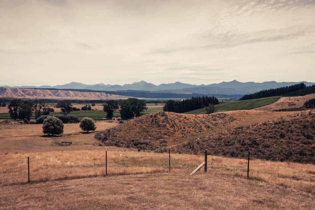
South of the Sounds, three valleys in close vicinity to Blenheim – Wairau, Southern, and Awatere – constitute New Zealand’s largest and most famous wine region. We don’t drink wine so are absolutely no help to oenophiles. But apart from the wine, there’s tremendous beauty in the Marlborough wine region: green vine in neat rows runs the width of the Wairau Plains and is surrounded on three sides by grassy hills, the color of wheat, and in the background the jagged mountain skyline of the Richmond Ranges. Only to the east, beyond Cloudy Bay, is the valley vulnerable and exposed to the at times rough sea conditions in Cook Strait.
I searched for days for accommodation that best reflects and appreciates this scenery. One offering a large porch and outdoor bath tub with sweeping views and a sense of complete privacy and quietude in the middle of nowhere. Omaka Valley Hut ticked all the boxes.
This stylish, little glamping hut in Hawkesbury is located off-grid on a working sheep and cattle farm with no man-made structure in sight except for livestock fencing and two white domes in the far distance, a satellite communications monitoring facility of the Government Communications Security Bureau (not even the national security agency managed to find a more remote location it seems). Moreover, and reason enough in itself to stay here, a 6.75km loop track meanders across the farm and climbs to Percy’s Lookout with views across the Wairau Plains, Cloudy Bay, and to the North Island. Throw in some vineyard lunches and dinners, and you couldn’t get a better feel for this region.
Hike | Point-to-point trail | 2-5 days
Queen Charlotte Track
Hike | Loop trail | 2-3 hours
Wairau Lagoon Walkway
“Uneventful,” said one review I came across when researching the Wairau Lagoon Walkway online, another claimed there wasn’t anything noteworthy to see other than the rusty shipwreck of the SS Waverly that sits abandoned in the lagoons at the halfway mark. A third called it: “a bit mundane”.
I pondered on the words “noteworthy” and “mundane”, decided they’re both highly subjective descriptions, and that we should give this walk a try anyway – run actually, because the trail is completely flat all the way and a beautiful place for a run.
Perhaps it was precisely the lack of “noteworthy”, which I enjoyed as we ran along a curving sandy walkway on a day with temperatures above 30 degrees in an otherwise cold summer. There was nothing out there in the wetlands to interfere with the desaturated tones of the lagoon under the glaring sun, the pale reddish sawgrass, watery blue sky, and murky shallow water.
Not even the rusting hulk of the wreck seemed out of place as it grew from a tiny reddish smudge floating above the featureless salt marsh plain into a great carcass of the steamer it once was, carrying supplies and coal back and forth to the West Coast. The seawater has successfully discoloured the wreck a reddish-brown hue to fit in well with nature’s colours.
As for “mundane” – I don’t often get to run across gorgeous wetlands on sweeping boardwalks with a view up Wairau Valley to the backdrop of rolling hills, the colour of oatmeal, and higher mountain ranges further back. The Wairau Lagoon Walkway was definitely a favourite run of mine in the Blenheim region, but opinions do differ, and if you’re looking for a challenging hike or some sort of entertainment along the way, this walk is not it.
track details.
Start/End: end of Hardings Road, near Blenheim
Directions: heading south from Blenheim turn left onto Hardings Rd and continue to the carpark at the far end of the road where the Wairau Lagoon Walkway starts
Distance: 7.8km
Time: 2-3 hours return (approx. 40 min running) / official DOC estimate 3 hours return
Elevation gain: none
Difficulty: very gentle, flat walk
Best time to walk/run: any time of the year, beautiful light in the evening
Options: suitable for running
Permits: none required
Further information: Official DOC informatio


On the Wairau Lagoon Walkway through the wetlands, nothing interferes with the desaturated tones of the lagoon under the glaring sun, the pale reddish sawgrass, watery blue sky, and murky shallow water.
Hike | Point-to-point trail | 1-2 days
Nydia Track
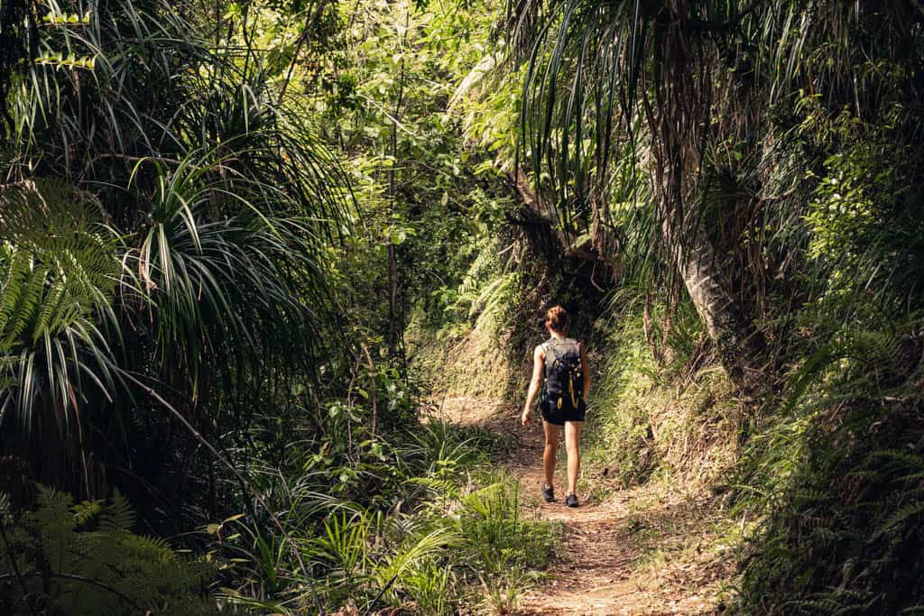
Beautiful coastal forest with tree ferns on the Nydia Track.
Hike | Out & back trail | 4 hours return
Archer Track
Walk | Out & back trail | 2-3 hours
Barrack Farm Track
| Note: Barrack Farm Track is a 6.75km loop trail on private farmland property in Hawkesbury, 20 min from Blenheim, available to guests of Omaka Valley Hut.
Hidden in the rolling hills of Hawkesbury Valley, we found a certain intimacy, a close connection to the land that came with the hand-drawn map we found in the hut, the well trodden farm tracks, the sheep and cattle that bolted in surprise at the sight of us, and the descriptive names of the landmarks we passed, like ‘Windy Gate’, ‘Salt Box’, and ‘Ollie’s Post’. The remoteness and privacy gave the impression of taking a walk on ‘our’ farm as we climbed towards Percy’s Lookout.
It was late in the afternoon when we arrived at the highest point along the trail, but still, the sun was beating down mercilessly and drained the semi-arid landscape of any vibrancy. It allowed for just two desaturated tones: the watery blue of the cloudless sky and roll upon roll of waving wheaten tussock. All else was lost to blinding blurriness.
So we sat on a grassy knoll for an hour and just watched the light grow soft, soothing the glare, as the setting sun smothered the field in gold and splashed purples and pinks on the baby blue sky. For a few short minutes, the sky was lit up by a spectacular display of nature’s fireworks with streaks of bold colours crisscrossing the darkening canvas, then night fell.
track details.
Start/End: Omaka Valley Hut, 20 min from Blenheim
Distance: 6.75km
Time: 1-2 hours
Elevation gain: 300m
Difficulty: easy walk across farm land; there are very few sign posts however and the path is overgrown in places making it difficult to follow the loop track. You might want to download the gpx data.
Best time to walk: any time of the year; early morning or evening to watch the sunrise/sunset from Percy’s Lookout
Permits: This walk is on private farmland property and accessible to guests of Omaka Valley Hut. It may not be open to the public. If you’re not staying at Omaka Valley Hut, maybe get in touch with Ros & Fen on airbnb to see if they allow day hikers.
Options: suitable for trail running


