Hike & Walk | Wanaka | New Zealand
Discover the best Hikes & Walks in Wanaka
Text | Anninka Kraus
Photography | Tobias Kraus

New Zealand Otago
I’m certain of it: Wanaka and Lake Hawea boast New Zealand’s best day hikes and the world’s most amazing mountain-lake panoramas. The two places are set a 15-minute drive apart, on the shores of their respective namesake lakes in the South Island’s Otago Region and share the same close proximity to crystal-clear water and soaring snow-capped peaks. Not only that, but between them, they also flaunt a dozen day hikes.
And not just any day hike but the very rare kind of trail that gains more than 1’000m in altitude to the summit of a 1’500m peak on a pram-friendly walkway, signposted and straightforward all the way to the top.
Yes, it’s still a relentless slog up (you’ve got to get up there somehow) but I’ve yet to find another place that makes peak bagging as easy as Wanaka. You could even relish bird’s eye views of both lakes in one day, by hiking Roys Peak and Grandview Mountain back to back for instance; that is if you can manage a 2’500m elevation gain and loss in one day.
Wanaka is located in Otago’s well-loved Queenstown-Lakes District but sees significantly fewer tourists than neighbouring Queenstown. The birthplace of adventure tourism is bigger, more popular, and insanely action-packed and draws a huge crowd of adrenaline junkies every year.
If instead, you’re looking for a small, less commercialised, and more laid-back place, Wanaka fits that bill perfectly, plus, it’s big-time outdoorsy. With everyone outside hiking, cycling, and walking, there’s an unmistakable bounce to this small resort town that reminds me of Queenstown twenty years ago, when I first visited. Before overtourism struck.
There’s plenty of hiking and walking tracks in Wanaka to suit all skill levels, but none of the day hikes in this post makes for a rough backcountry wilderness experience. If that’s what you’re after, consider the multiday trails in the area, like Rees-Dart Track, Cascade Saddle Route, or Gillespie Pass Circuit in Mt Aspiring National Park.
jump ahead.


On the Roys Peak Track, the trail winds up the mountain as a white line snaking through WeetBix-colored tussock in tight switchbacks to famous Roys Peak viewpoint.
what to expect.
Wanaka has New Zealand’s best day hikes and the world’s most beautiful mountain-lake panoramas
The small resort town is outdoorsy and vibrant with a great laid-back, friendly vibe and lovely cafes and restaurants. Lake Hawea is just as beautiful as Lake Wanaka and only a 15min drive away, so you can easily enjoy both in one visit
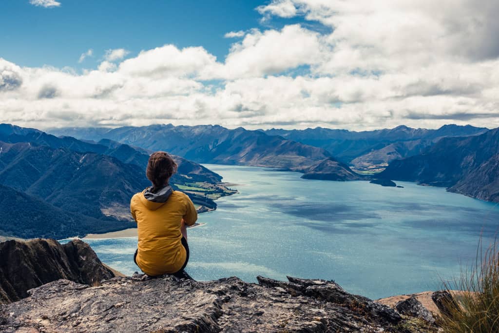
Hike up famous Roys Peak and marvel at the otherworldly views across Lake Wanaka to the snow-clad Southern Alps, or walk to the summit of 1385m Isthmus Peak, perfectly positioned above Lake Wanaka and Lake Hawea and surrounded by sublime mountain scenery
location & trail information.
Directions: Wanaka is set on the southern end of its pristine namesake lake in New Zealand’s South Island. The mountain resort town is the gateway to Mount Aspiring National Park and popular for its many hiking trails. Wanaka is a 1-hour drive from Queenstown and easily accessible by car on SH6 and Intercity bus. Ritchies also provides regular scheduled shuttle service between Wanaka and Queenstown. Wanaka airport is used mostly for scenic and charter flights, but Sounds Air runs daily direct flights between Christchurch and Wanaka. The closest airport served by Air New Zealand is Queenstown Airport.
How to get around: by car, as there’s no local public transport | if you stay in Wanaka city centre, you can easily walk everywhere in town but will need to organize a shuttle service or private track transfer to trail heads
When to visit: Summer (December to February) is the best time for hiking in the lower South Island. But regardless of the time of year, the diffused, soft light at sunrise and sunset will allow vibrant and rich colours that are lost in the bright sunlight at midday. Early and late in the day, you’ll also meet fewer tourists on the well-worn trails.
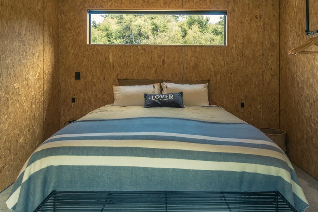
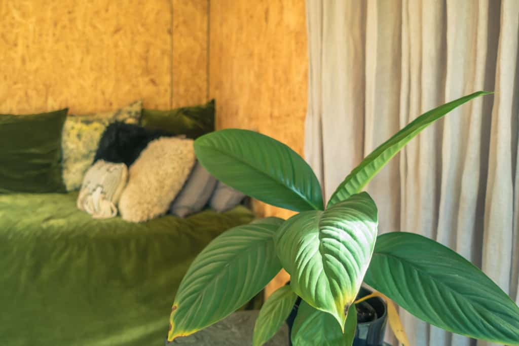
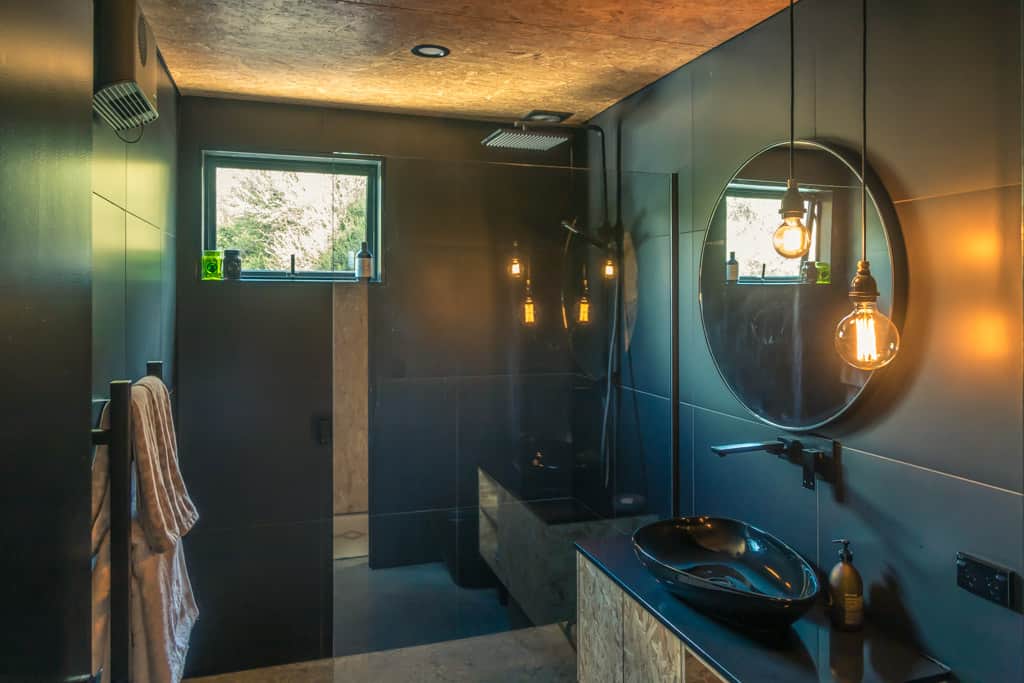
Where to stay: Koliba
Where to eat: Big Fig – delicious slow food fast food
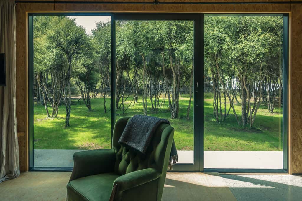
Beautifully designed and decorated Koliba cottage in Albert Town near Wanaka.

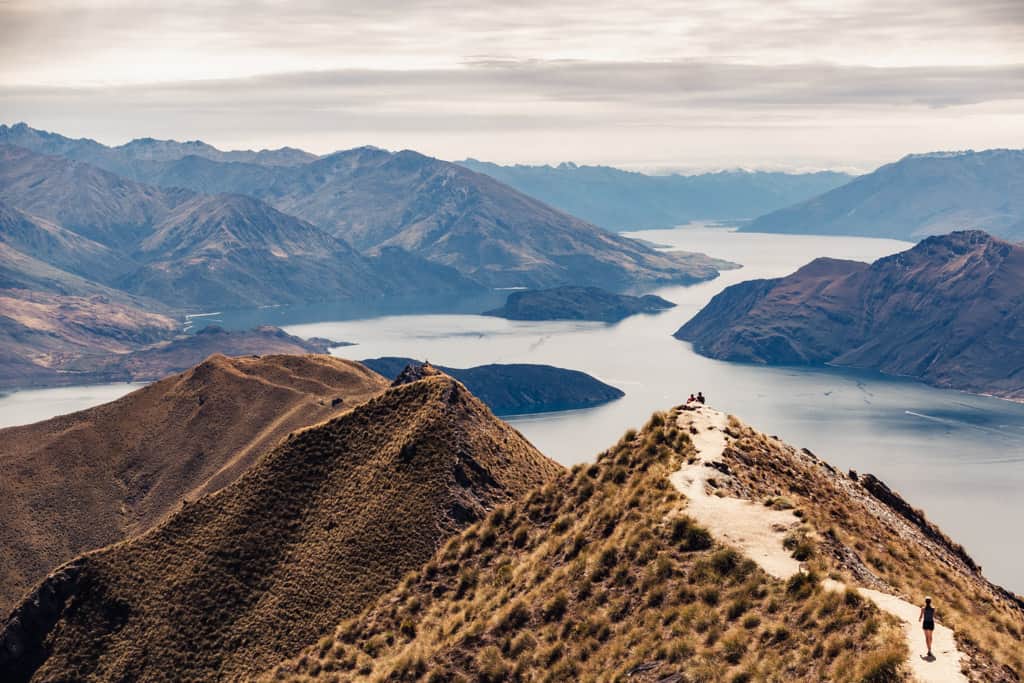
The brilliant 360° panorama from Roys Peak Track, of Lake Wanaka spreading beautifully north towards the Makarora Valley and in the northwest meeting the Matukituki River and a snow-capped mountain range.
Hike | Out & back trail | 4-6 hours
Roys Peak Track
Hike | Loop trail | 1 hour
Mt Iron Track
Mount Iron is a glacier carved rocky knoll in Wanaka, rising to 549m above the surrounding countryside. Close to town, the 4.5km kidney-shaped circuit is more easily accessible and shorter than most other trails in the area, but has equally magnificent views over Lake Wanaka, Mount Aspiring, Mt Alta, the Pisa Range, and into the Matukituki Valley.
We walked this trail in Birkenstock sandals (probably not recommended as there’s some uneven terrain and loose gravel sections) with an hour to spare between grocery shopping and dinner on a Friday night, when the track was embraced by locals walking and running here after work. It’s a great little loop with an interesting elevation profile and one that I’d surely run a lot if I lived in Wanaka.
From the car park, follow the track to the left up the western side of Mt Iron through kanuka scrubland and watch as dozens of rabbits scatter in waves every time you turn a corner. Continue along the rocky summit plateau to the summit viewpoint at 549m, and return via the eastern side down and around the hill back to the car park.
track details.
Start/End: car park off SH84, 2km east of Wanaka
Directions: follow SH84 in the direction of Puzzling World and you’ll see the car park on your left just opposite Three Parks commercial precinct
Distance: 4.5km
Time: 1 hour
Elevation gain: 230 meters (+/-) (lowest point: 323m / highest point: 536m)
Difficulty: easy
Best time to walk: all year
Permits: none required
Options: suitable for trail running
Further information: Official DOC information
Hike | Out & back trail | 4-6 hours
Isthmus Peak Track
Isthmus Peak takes its name from the isthmus, a narrow rocky ridge that divides Lake Hawea and Lake Wanaka, called ‘The Neck’.
Perfectly positioned above the two lakes in Matatiaho Conservation Area and surrounded by sublime mountain scenery, the 360-degree view from the 1385m peak is outstanding.
Hike | Out & back trail | 3-4 hours
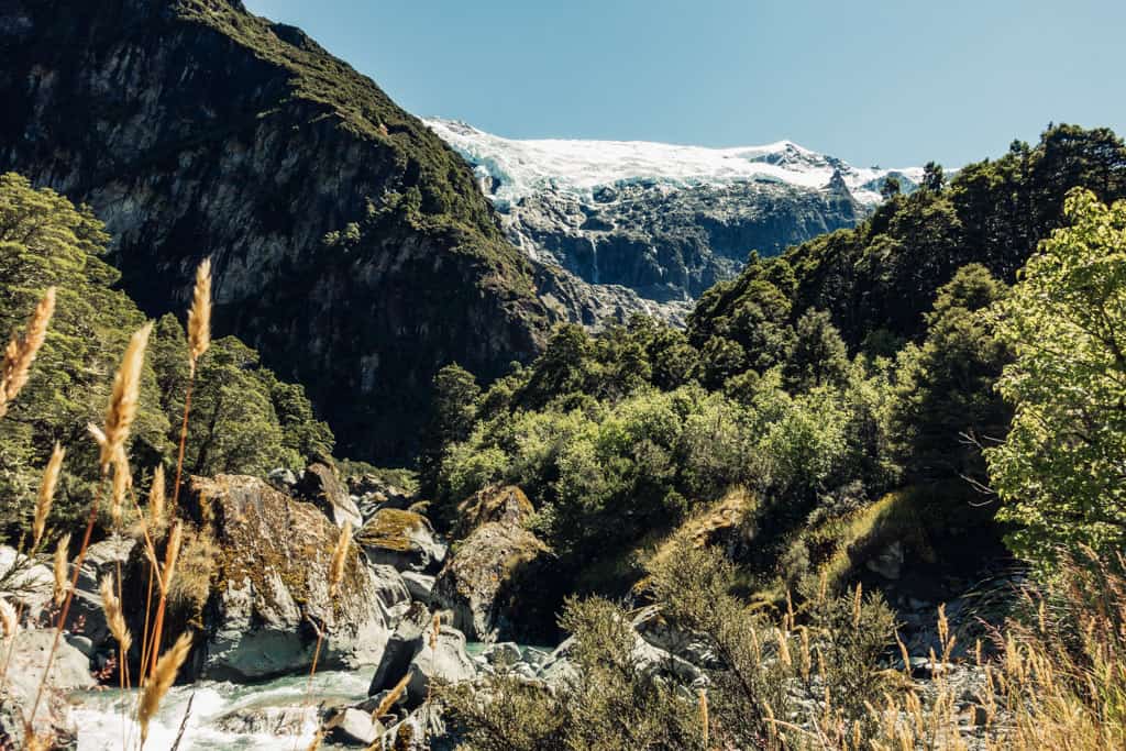
Rob Roy Track
The fabulous Rob Roy Track in the West Matukituki Valley, 54km west of Wanaka, is a 3hr hike on a well-graded path takes you into the Rob Roy Basin to 765m and face to face with a huge wall of ice clinging precariously to the mountain and several impressive waterfalls cascading down sheer rock cliffs.
Walk | Out & back trail | 2-3 hours
Gladstone Track
This well-maintained track is shared with New Zealand’s Te Araroa long distance hiking trail, but on four runs from Scott’s Beach to John Creek in a week (we really did love that lakefront) we only met local runners, families on mountain bikes, and people walking their dog after work.
There’re a few gentle ups and downs as the track dips down into small bays but mostly the trail stays on the cliff top well above the lake all the way to the halfway mark at John Creek, a tiny collection of holiday baches crouched on the lakeshore where the Grandview Range runs steeply down to the water’s edge.
To imagine that Lake Hawea ever looked any different than its picture-perfect self –hemmed into a glacial valley by the Matatiaho and Hawea conservation areas rising to the left and right and stretching far back to where the water meets yet another mountain skyline, this one dominated by Sentinel Peak – is almost impossible. It did however look much different; before a hydro storage dam was built and the lake artificially raised 20 metres in 1958. More beautiful even. Those who witnessed the changes consider them mostly a loss to the lake’s scenic beauty.
You return via the same track and finish at Scott’s Beach. It’s a driftwood strewn pebble beach and the crystal-clear water is chilly, but perfect for a (very) refreshing quick dip on a hot day.
track details.
Start/End: Scott’s Beach, Hawea
Distance: 11.5km (official DOC estimate: 13.8km return Hāwea dam to Johns Creek Recreation Reserve)
Time: 2-3 hr (official DOC estimate: 3:30 hr return Hāwea dam to Johns Creek Recreation Reserve)
Elevation gain: 40 meters (+/-) (lowest point: 349m / highest point: 370m)
Difficulty: easy
Best time to walk: all year
Permits: none required
Options: suitable for biking, walking, running
Further information: Official DOC information


Hike | Out & back trail | 4-6 hours
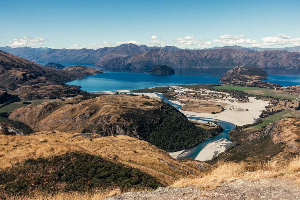
Grandview Mountain Track
This track, previously known as Grandview Creek Track, gains almost 1’000m in altitude to the 1’398m summit of Grandview Mountain and offers some literally grand views of Lake Hawea, Wanaka, and the Southern Alps.
The Grandview Mountain Track, previously known as Grandview Creek Track, gains almost 1’000m in altitude to the 1’398m summit of Grandview Mountain and offers some literally grand views of Lake Hawea, Wanaka, and the Southern Alps.
Hike | Loop trail | 2-3 hours
Diamond Lake Track & Rocky Mountain Track
Diamond Lake Conservation Area features three easy to moderate loop tracks that sit next to each other like beads on a string and increase in difficulty but also scenic beauty with altitude gain.
Walk | Out & back trail | 1 hour
Beacon Point Walk
This gentle, pram-friendly walkway meanders along the lakeshore between Beacon Point and Bremner Bay and has some lovely views across the water to the surrounding mountains.
It’s a great place to exercise and many of the cyclists and runners who passed us continued past Bremner Bay and Eely Point to the marina and Wanaka town centre. Others, mainly families with children on summer vacation, were taking it easy, swimming and having picnics on the beaches at Beacon Point and Bremner Bay.
track details.
Start/End: Beacon Point at the end of Beacon Point Road in Wanaka
Distance: 4.3km (official DOC estimate: 3km return)
Time: 1 hr return
Elevation gain: – (lowest point: 283m / highest point: 291m)
Difficulty: very gentle, flat trail
Best time to walk: all year
Permits: none required
Options: suitable for running and biking
Further information: Official DOC information