Hike | Wanaka | New Zealand
Hiking the Rob Roy Glacier Track near Wanaka
Text | Anninka Kraus
Photography | Tobias Kraus

New Zealand Otago
Excursions into Mount Aspiring National Parks, New Zealand’s third-largest national park straddling the mountain divide between the Otago and Westland regions, usually involve long overnight tramps, steep altitude gains, and taxing descents over loose rock.
The drudgery is worth it, certainly, for the alpine wilderness is spectacular, but there’s another, easier way (besides a helicopter ride): the fabulous Rob Roy Track in the West Matukituki Valley, 54km west of Wanaka.
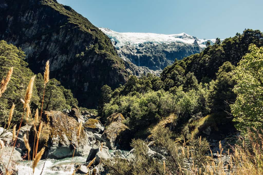
This 3hr hike on a well-graded path takes you into the Rob Roy Basin to 765m and face to face with a huge wall of ice clinging precariously to the mountain and several impressive waterfalls cascading down sheer rock cliffs.
We were thrilled to learn that the track had just reopened after an 18-months closure due to a slip and the next day drove out to the trail head at Raspberry Flats car park. In a vehicle without high clearance, accessing the trail head on the rutted dirt road with several streams to ford may already be your greatest challenge. If you’ve got a rental, consider hitching or car-sharing to the trailhead.
From Raspberry Flats car park, the track initially leads up into the valley, through yellow carpets of wildflowers and soon comes up to a rope swing bridge spanning the West Matukituki River. On the opposite river bank, the trail disappears into beech and native forest and gradually climbs alongside Rob Roy Stream churning through a narrow gorge to the Lower Lookout.
Keep following the trail and work your way across a scree filled gully and some broken rock until the track emerges from the bush into the Rob Roy Basin.
This is a truly great spot, directly vis-a-vis the hanging glaciers beneath Mount Rob Roy and waterfalls spilling over the cliff’s edge and pouring down the barren rock face. You return by the same track.
related


The hanging glaciers beneath Mount Rob Roy and waterfalls spilling over the cliff’s edge and pouring down the barren rock face.
Wanaka | New Zealand
Hike | Out & back trail | 3-4 hours
track details.
Start/End: Raspberry Creek car park, 54 km west of Wanaka
Directions: follow Mt Aspiring Road for 54km to the Raspberry Creek car park, at the end of the road. The last 30km are unsealed – 4WD with high clearance is recommended.
Time: 3 hr (official DOC estimate: 3-4hr return)
Distance: 10.4km (official DOC estimate: 10km return)
Elevation gain: 470 meters (+/-) (lowest point: 370m / highest point: 765m)
Difficulty: easy
Best time to hike: summer and autumn
Options: suitable for trail running
Permits: none required, but track access is restricted to the lower lookout when avalanche danger is present (May–November)
Further information: Official DOC information